
 Maureville
Samoëns
Gréning
Toulouse
Volx
Goudet
Méhoncourt
Saint-Hymer
Pontcarré
Maureville
Samoëns
Gréning
Toulouse
Volx
Goudet
Méhoncourt
Saint-Hymer
Pontcarré
POIRON DABIN on the map, Vertou, France
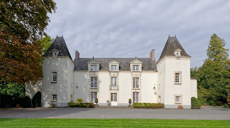
Photo
Where is located POIRON DABIN
POIRON DABIN — local attraction, which is located at no data and belongs to the category — -. Average visitor rating for this place — 4.6 (according to 80 ratings, information from open sources and relevant for 2022).
Exact location — POIRON DABIN, marked on the map with a red marker.
You can get directions to POIRON DABIN on the map from your location.
What else is interesting in Vertou? You can see all the sights if you go to the city page.
Coordinates
POIRON DABIN, France coordinates in decimal format: latitude — 47.162358152638205, longitude — -1.3695173748354204. When converted to degrees, minutes, seconds POIRON DABIN has the following coordinates: 47°9′44.49 north latitude and -1°22′10.26 east longitude.
Nearby cities
The largest cities that are located nearby:
- Nantes — 8 km
- Angers — 76 km
- Rennes — 106 km
- Le Mans — 155 km
- Tours — 163 km
- Caen — 237 km
- Limoges — 257 km
- Brest — 259 km
- Orléans — 264 km
- Bordeaux — 267 km
- Le Havre — 281 km
- Rouen — 312 km
- Boulogne-Billancourt — 327 km
- Clermont-Ferrand — 384 km
- Bournemouth
 (United Kingdom) — 394 km
 - Amiens — 404 km
- Portsmouth (United Kingdom) — 405 km
- Southampton (United Kingdom) — 414 km
- Eastbourne (United Kingdom) — 417 km
Distance to the capital
Distance to the capital (Paris) is about — 335 km.