
 Maureville
Samoëns
Gréning
Toulouse
Volx
Goudet
Méhoncourt
Saint-Hymer
Pontcarré
Maureville
Samoëns
Gréning
Toulouse
Volx
Goudet
Méhoncourt
Saint-Hymer
Pontcarré
Mausolée Cadoudal d'Auray on the map, Auray, France
Photo
Where is located Mausolée Cadoudal d'Auray
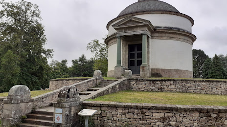
Mausolée Cadoudal d'Auray — local attraction, which is located at 4 All. du Mausolée, 56400 Auray, France and belongs to the category — park. Average visitor rating for this place — 4.3 (according to 120 ratings, information from open sources and relevant for 2022).
Exact location — Mausolée Cadoudal d'Auray, marked on the map with a red marker.
You can get directions to Mausolée Cadoudal d'Auray on the map from your location.
What else is interesting in Auray? You can see all the sights if you go to the city page.
Coordinates
Mausolée Cadoudal d'Auray, France coordinates in decimal format: latitude — 47.66159786238838, longitude — -2.9939929748181546. When converted to degrees, minutes, seconds Mausolée Cadoudal d'Auray has the following coordinates: 47°39′41.75 north latitude and -2°59′38.37 east longitude.
Nearby cities
The largest cities that are located nearby:
- Rennes — 109 km
- Nantes — 118 km
- Brest — 136 km
- Angers — 182 km
- Le Mans — 238 km
- Caen — 253 km
- Tours — 276 km
- Le Havre — 300 km
- Exeter
 (United Kingdom) — 340 km
 - Bournemouth (United Kingdom) — 346 km
- Rouen — 353 km
- Orléans — 364 km
- Bordeaux — 365 km
- Portsmouth (United Kingdom) — 373 km
- Southampton (United Kingdom) — 375 km
- Limoges — 385 km
- Boulogne-Billancourt — 402 km
- Eastbourne (United Kingdom) — 412 km
- Bristol (Great Britain) — 420 km
Distance to the capital
Distance to the capital (Paris) is about — 417 km.