
 Maureville
Samoëns
Gréning
Toulouse
Volx
Goudet
Méhoncourt
Saint-Hymer
Pontcarré
Maureville
Samoëns
Gréning
Toulouse
Volx
Goudet
Méhoncourt
Saint-Hymer
Pontcarré
Chapelle Sainte-Avoye on the map, Auray, France
Photo
Where is located Chapelle Sainte-Avoye
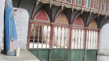
Chapelle Sainte-Avoye — local attraction, which is located at Sainte-Avoye, 56400 Pluneret, France and belongs to the category — chapel. Average visitor rating for this place — 4.5 (according to 91 rating, information from open sources and relevant for 2022).
Exact location — Chapelle Sainte-Avoye, marked on the map with a red marker.
You can get directions to Chapelle Sainte-Avoye on the map from your location.
What else is interesting in Auray? You can see all the sights if you go to the city page.
Coordinates
Chapelle Sainte-Avoye, France coordinates in decimal format: latitude — 47.65119895591117, longitude — -2.9454168748185183. When converted to degrees, minutes, seconds Chapelle Sainte-Avoye has the following coordinates: 47°39′4.32 north latitude and -2°56′43.5 east longitude.
Nearby cities
The largest cities that are located nearby:
- Rennes — 109 km
- Nantes — 118 km
- Brest — 136 km
- Angers — 182 km
- Le Mans — 238 km
- Caen — 253 km
- Tours — 276 km
- Le Havre — 300 km
- Exeter
 (United Kingdom) — 340 km
 - Bournemouth (United Kingdom) — 346 km
- Rouen — 353 km
- Orléans — 364 km
- Bordeaux — 365 km
- Portsmouth (United Kingdom) — 373 km
- Southampton (United Kingdom) — 375 km
- Limoges — 385 km
- Boulogne-Billancourt — 402 km
- Eastbourne (United Kingdom) — 412 km
- Bristol (Great Britain) — 420 km
Distance to the capital
Distance to the capital (Paris) is about — 415 km.