
 Maureville
Samoëns
Gréning
Toulouse
Volx
Goudet
Méhoncourt
Saint-Hymer
Pontcarré
Maureville
Samoëns
Gréning
Toulouse
Volx
Goudet
Méhoncourt
Saint-Hymer
Pontcarré
Étang Saint-Nicolas on the map, Avrillé, France
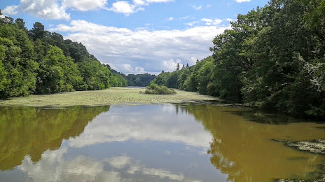
Photo
Where is located Étang Saint-Nicolas
Étang Saint-Nicolas — local attraction, which is located at 3.62 km and belongs to the category — -. Average visitor rating for this place — 4.6 (according to 27 ratings, information from open sources and relevant for 2022).
Exact location — Étang Saint-Nicolas, marked on the map with a red marker.
You can get directions to Étang Saint-Nicolas on the map from your location.
What else is interesting in Avrillé? You can see all the sights if you go to the city page.
Coordinates
Étang Saint-Nicolas, France coordinates in decimal format: latitude — 47.48145228709238, longitude — -0.5929346002354058. When converted to degrees, minutes, seconds Étang Saint-Nicolas has the following coordinates: 47°28′53.23 north latitude and -0°35′34.56 east longitude.
Nearby cities
The largest cities that are located nearby:
- Angers — 4 km
- Nantes — 79 km
- Le Mans — 81 km
- Tours — 96 km
- Rennes — 105 km
- Caen — 186 km
- Orléans — 190 km
- Le Havre — 226 km
- Limoges — 233 km
- Rouen — 246 km
- Boulogne-Billancourt — 253 km
- Bordeaux — 295 km
- Brest — 302 km
- Amiens — 335 km
- Clermont-Ferrand — 342 km
- Eastbourne
 (United Kingdom) — 366 km
 - Bournemouth (United Kingdom) — 367 km
- Portsmouth (United Kingdom) — 368 km
- Southampton (United Kingdom) — 381 km
Distance to the capital
Distance to the capital (Paris) is about — 267 km.