
 Maureville
Samoëns
Gréning
Toulouse
Volx
Goudet
Méhoncourt
Saint-Hymer
Pontcarré
Maureville
Samoëns
Gréning
Toulouse
Volx
Goudet
Méhoncourt
Saint-Hymer
Pontcarré
Domaines Schlumberger on the map, Guebwiller, France
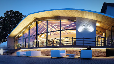
Photo
Where is located Domaines Schlumberger
Domaines Schlumberger — local attraction, which is located at Siège social :, 100 rue Theodore Deck, 3 Rue des Cr Populaires, 68500 Guebwiller, France and belongs to the category — winery. Average visitor rating for this place — 4.6 (according to 57 ratings, information from open sources and relevant for 2022).
Exact location — Domaines Schlumberger, marked on the map with a red marker.
You can get directions to Domaines Schlumberger on the map from your location.
What else is interesting in Guebwiller? You can see all the sights if you go to the city page.
Coordinates
Domaines Schlumberger, France coordinates in decimal format: latitude — 47.91205661871776, longitude — 7.206239625190571. When converted to degrees, minutes, seconds Domaines Schlumberger has the following coordinates: 47°54′43.4 north latitude and 7°12′22.46 east longitude.
Nearby cities
The largest cities that are located nearby:
- Mulhouse — 20 km
- Freiburg
 (Germany) — 48 km
 - Basel
 (Switzerland) — 48 km
 - Strasbourg — 83 km
- Bern (Switzerland) — 108 km
- Nancy — 114 km
- Besançon — 116 km
- Zurich (Switzerland) — 116 km
- Saarbrücken (Germany) — 148 km
- Karlsruhe (Germany) — 149 km
- Pforzheim (Germany) — 153 km
- Metz — 153 km
- Lausanne (Switzerland) — 160 km
- Reutlingen (Germany) — 160 km
- Stuttgart (Germany) — 173 km
- Dijon — 175 km
- Ludwigshafen (Germany) — 195 km
- Heidelberg (Germany) — 195 km
- Mannheim (Germany) — 196 km
Distance to the capital
Distance to the capital (Paris) is about — 374 km.