
 Maureville
Samoëns
Gréning
Toulouse
Volx
Goudet
Méhoncourt
Saint-Hymer
Pontcarré
Maureville
Samoëns
Gréning
Toulouse
Volx
Goudet
Méhoncourt
Saint-Hymer
Pontcarré
Espace Vauban on the map, Briançon, France
Photo
Where is located Espace Vauban
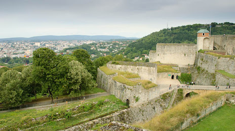
Espace Vauban — local attraction, which is located at Citadelle de, 25000 Besançon, France and belongs to the category — museum. Average visitor rating for this place — 4.2 (according to 6 ratings, information from open sources and relevant for 2022).
Exact location — Espace Vauban, marked on the map with a red marker.
You can get directions to Espace Vauban on the map from your location.
What else is interesting in Briançon? You can see all the sights if you go to the city page.
Coordinates
Espace Vauban, France coordinates in decimal format: latitude — 44.90068148103547, longitude — 6.6440368250881. When converted to degrees, minutes, seconds Espace Vauban has the following coordinates: 44°54′2.45 north latitude and 6°38′38.53 east longitude.
Nearby cities
The largest cities that are located nearby:
- Grenoble — 78 km
- Turin
 (Italy) — 84 km
 - Nice — 140 km
- Geneva
 (Switzerland) — 149 km
 - Novara (Italy) — 165 km
- Villeurbanne — 166 km
- Lyon — 169 km
- Lausanne (Switzerland) — 179 km
- Aix-en-Provence — 179 km
- Saint-Étienne — 185 km
- Genoa (Italy) — 190 km
- Toulon — 205 km
- Marseille — 205 km
- Milan (Italy) — 207 km
- Nimes — 217 km
- Monza (Italy) — 217 km
- Bern (Switzerland) — 234 km
- Bergamo (Italy) — 250 km
- Besançon — 263 km
Distance to the capital
Distance to the capital (Paris) is about — 548 km.