
 Maureville
Samoëns
Gréning
Toulouse
Volx
Goudet
Méhoncourt
Saint-Hymer
Pontcarré
Maureville
Samoëns
Gréning
Toulouse
Volx
Goudet
Méhoncourt
Saint-Hymer
Pontcarré
Fort de l'Heurt on the map, Le Portel, France
Photo
Where is located Fort de l'Heurt
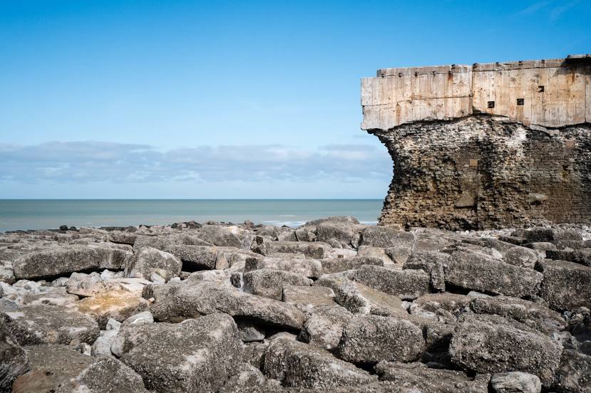
Fort de l'Heurt — local attraction, which is located at 62480 Le Portel, France and belongs to the category — fortress. Average visitor rating for this place — 4.8 (according to 20 ratings, information from open sources and relevant for 2022).
Exact location — Fort de l'Heurt, marked on the map with a red marker.
You can get directions to Fort de l'Heurt on the map from your location.
What else is interesting in Le Portel? You can see all the sights if you go to the city page.
Coordinates
Fort de l'Heurt, France coordinates in decimal format: latitude — 50.706334904175066, longitude — 1.569069725290104. When converted to degrees, minutes, seconds Fort de l'Heurt has the following coordinates: 50°42′22.81 north latitude and 1°34′8.65 east longitude.
Nearby cities
The largest cities that are located nearby:
- Eastbourne
 (United Kingdom) — 90 km
 - Gillingham (United Kingdom) — 103 km
- Amiens — 103 km
- Lille — 104 km
- Southend-on-Sea (United Kingdom) — 110 km
- Basildon (United Kingdom) — 122 km
- Crawley (United Kingdom) — 130 km
- Chelmsford (United Kingdom) — 137 km
- Sutton (United Kingdom) — 142 km
- Rouen — 144 km
- London (United Kingdom) — 147 km
- Ipswich (United Kingdom) — 152 km
- Le Havre — 171 km
- Watford (United Kingdom) — 171 km
- Slough (United Kingdom) — 174 km
- Portsmouth (United Kingdom) — 187 km
- Luton (United Kingdom) — 188 km
- Cambridge (United Kingdom) — 193 km
- Brussels
 (Belgium) — 194 km
Distance to the capital
Distance to the capital (Paris) is about — 213 km.