
 Maureville
Samoëns
Gréning
Toulouse
Volx
Goudet
Méhoncourt
Saint-Hymer
Pontcarré
Maureville
Samoëns
Gréning
Toulouse
Volx
Goudet
Méhoncourt
Saint-Hymer
Pontcarré
Site de Castets on the map, Mont-de-Marsan, France
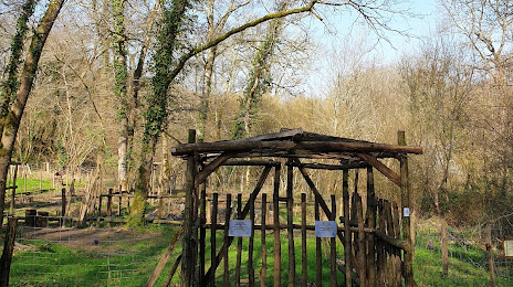
Photo
Where is located Site de Castets
Site de Castets — local attraction, which is located at 40090 Bougue, France and belongs to the category — park. Average visitor rating for this place — 4.3 (according to 39 ratings, information from open sources and relevant for 2022).
Exact location — Site de Castets, marked on the map with a red marker.
You can get directions to Site de Castets on the map from your location.
What else is interesting in Mont-de-Marsan? You can see all the sights if you go to the city page.
Coordinates
Site de Castets, France coordinates in decimal format: latitude — 43.892178886518856, longitude — -0.3888827749450682. When converted to degrees, minutes, seconds Site de Castets has the following coordinates: 43°53′31.84 north latitude and -0°23′19.98 east longitude.
Nearby cities
The largest cities that are located nearby:
- Bordeaux — 105 km
- San Sebastián
 (Spain) — 135 km
 - Pamplona (Spain) — 151 km
- Toulouse — 159 km
- Bilbao (Spain) — 208 km
- Vitoria-Gasteiz (Spain) — 211 km
- Logroño (Spain) — 224 km
- Zaragoza (Spain) — 250 km
- Limoges — 254 km
- Lleida (Spain) — 268 km
- Santander (Spain) — 270 km
- Perpignan — 306 km
- Burgos (Spain) — 312 km
- Terrassa (Spain) — 331 km
- Sabadell (Spain) — 338 km
- Tarragona (Spain) — 339 km
- Clermont-Ferrand — 346 km
- Montpellier — 352 km
- Santa Coloma de Gramenet (Spain) — 352 km
Distance to the capital
Distance to the capital (Paris) is about — 591 km.