
 Maureville
Samoëns
Gréning
Toulouse
Volx
Goudet
Méhoncourt
Saint-Hymer
Pontcarré
Maureville
Samoëns
Gréning
Toulouse
Volx
Goudet
Méhoncourt
Saint-Hymer
Pontcarré
Fort Rapp on the map, Hoenheim, France
Photo
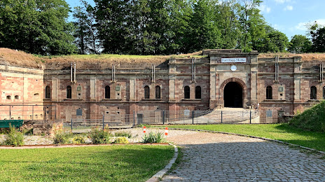
Where is located Fort Rapp
Fort Rapp — local attraction, which is located at 67116 Reichstett, France and belongs to the category — historical landmark. Average visitor rating for this place — 4.6 (according to 51 rating, information from open sources and relevant for 2022).
Exact location — Fort Rapp, marked on the map with a red marker.
You can get directions to Fort Rapp on the map from your location.
What else is interesting in Hoenheim? You can see all the sights if you go to the city page.
Coordinates
Fort Rapp, France coordinates in decimal format: latitude — 48.639693576394606, longitude — 7.756412625216066. When converted to degrees, minutes, seconds Fort Rapp has the following coordinates: 48°38′22.9 north latitude and 7°45′23.09 east longitude.
Nearby cities
The largest cities that are located nearby:
- Strasbourg — 5 km
- Karlsruhe
 (Germany) — 63 km
 - Freiburg (Germany) — 69 km
- Pforzheim (Germany) — 75 km
- Saarbrücken (Germany) — 88 km
- Mulhouse — 101 km
- Stuttgart (Germany) — 105 km
- Reutlingen (Germany) — 107 km
- Ludwigshafen (Germany) — 107 km
- Heidelberg (Germany) — 108 km
- Mannheim (Germany) — 109 km
- Nancy — 115 km
- Basel
 (Switzerland) — 117 km
 - Heilbronn (Germany) — 120 km
- Metz — 127 km
- Trier (Germany) — 148 km
- Zurich (Switzerland) — 150 km
- Darmstadt (Germany) — 152 km
- Mainz (Germany) — 156 km
Distance to the capital
Distance to the capital (Paris) is about — 397 km.