
 Maureville
Samoëns
Gréning
Toulouse
Volx
Goudet
Méhoncourt
Saint-Hymer
Pontcarré
Maureville
Samoëns
Gréning
Toulouse
Volx
Goudet
Méhoncourt
Saint-Hymer
Pontcarré
Le parc de la Roseraie on the map, Bourg-la-Reine, France
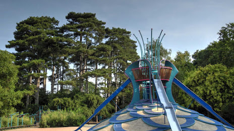
Photo
Where is located Le parc de la Roseraie
Le parc de la Roseraie — local attraction, which is located at 1 Rue Watel, 94240 L'Haÿ-les-Roses, France and belongs to the category — park. Average visitor rating for this place — 4.4 (according to 1497 ratings, information from open sources and relevant for 2022).
Exact location — Le parc de la Roseraie, marked on the map with a red marker.
You can get directions to Le parc de la Roseraie on the map from your location.
What else is interesting in Bourg-la-Reine? You can see all the sights if you go to the city page.
Coordinates
Le parc de la Roseraie, France coordinates in decimal format: latitude — 48.774849761977016, longitude — 2.3343040252208334. When converted to degrees, minutes, seconds Le parc de la Roseraie has the following coordinates: 48°46′29.46 north latitude and 2°20′3.49 east longitude.
Nearby cities
The largest cities that are located nearby:
- Boulogne-Billancourt — 9 km
- Orléans — 102 km
- Rouen — 114 km
- Amiens — 123 km
- Reims — 135 km
- Le Havre — 177 km
- Le Mans — 178 km
- Tours — 196 km
- Caen — 199 km
- Lille — 211 km
- Charleroi
 (Belgium) — 234 km
 - Angers — 259 km
- Namur (Belgium) — 259 km
- Dijon — 260 km
- Eastbourne
 (United Kingdom) — 261 km
 - Brussels (Belgium) — 269 km
- Metz — 282 km
- Nancy — 282 km
- Rennes — 304 km
Distance to the capital
Distance to the capital (Paris) is about — 9 km.