
 Maureville
Samoëns
Gréning
Toulouse
Volx
Goudet
Méhoncourt
Saint-Hymer
Pontcarré
Maureville
Samoëns
Gréning
Toulouse
Volx
Goudet
Méhoncourt
Saint-Hymer
Pontcarré
Parc Andersen on the map, Bois-Guillaume, France
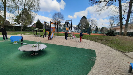
Photo
Where is located Parc Andersen
Parc Andersen — local attraction, which is located at 2745-2859 Rte de Neufchâtel, 76230 Bois-Guillaume, France and belongs to the category — park. Average visitor rating for this place — 4.3 (according to 39 ratings, information from open sources and relevant for 2022).
Exact location — Parc Andersen, marked on the map with a red marker.
You can get directions to Parc Andersen on the map from your location.
What else is interesting in Bois-Guillaume? You can see all the sights if you go to the city page.
Coordinates
Parc Andersen, France coordinates in decimal format: latitude — 49.466795402894505, longitude — 1.1159136252454485. When converted to degrees, minutes, seconds Parc Andersen has the following coordinates: 49°28′0.46 north latitude and 1°6′57.29 east longitude.
Nearby cities
The largest cities that are located nearby:
- Rouen — 3 km
- Le Havre — 72 km
- Amiens — 96 km
- Boulogne-Billancourt — 107 km
- Caen — 112 km
- Eastbourne
 (United Kingdom) — 155 km
 - Le Mans — 175 km
- Orléans — 183 km
- Lille — 187 km
- Crawley (United Kingdom) — 203 km
- Reims — 212 km
- Portsmouth (United Kingdom) — 214 km
- Gillingham (United Kingdom) — 216 km
- Sutton (United Kingdom) — 228 km
- Southend-on-Sea (United Kingdom) — 231 km
- Tours — 232 km
- Basildon (United Kingdom) — 237 km
- Southampton (United Kingdom) — 237 km
- London (United Kingdom) — 241 km
Distance to the capital
Distance to the capital (Paris) is about — 113 km.