
 Maureville
Samoëns
Gréning
Toulouse
Volx
Goudet
Méhoncourt
Saint-Hymer
Pontcarré
Maureville
Samoëns
Gréning
Toulouse
Volx
Goudet
Méhoncourt
Saint-Hymer
Pontcarré
Le parc des Lilas on the map, Vitry-sur-Seine, France
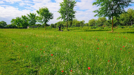
Photo
Where is located Le parc des Lilas
Le parc des Lilas — local attraction, which is located at 181-191 Av. Lemerle Vetter, 94400 Vitry-sur-Seine, France and belongs to the category — park. Average visitor rating for this place — 4.2 (according to 594 ratings, information from open sources and relevant for 2022).
Exact location — Le parc des Lilas, marked on the map with a red marker.
You can get directions to Le parc des Lilas on the map from your location.
What else is interesting in Vitry-sur-Seine? You can see all the sights if you go to the city page.
Coordinates
Le parc des Lilas, France coordinates in decimal format: latitude — 48.83279356885484, longitude — 2.3673278127036785. When converted to degrees, minutes, seconds Le parc des Lilas has the following coordinates: 48°49′58.06 north latitude and 2°22′2.38 east longitude.
Nearby cities
The largest cities that are located nearby:
- Boulogne-Billancourt — 13 km
- Orléans — 105 km
- Rouen — 118 km
- Amiens — 122 km
- Reims — 129 km
- Le Havre — 182 km
- Le Mans — 184 km
- Tours — 201 km
- Caen — 205 km
- Lille — 208 km
- Charleroi
 (Belgium) — 230 km
 - Namur (Belgium) — 254 km
- Dijon — 256 km
- Eastbourne
 (United Kingdom) — 264 km
 - Angers — 265 km
- Brussels (Belgium) — 265 km
- Metz — 276 km
- Nancy — 277 km
- Liège (Belgium) — 302 km
Distance to the capital
Distance to the capital (Paris) is about — 3 km.