
 Maureville
Samoëns
Gréning
Toulouse
Volx
Goudet
Méhoncourt
Saint-Hymer
Pontcarré
Maureville
Samoëns
Gréning
Toulouse
Volx
Goudet
Méhoncourt
Saint-Hymer
Pontcarré
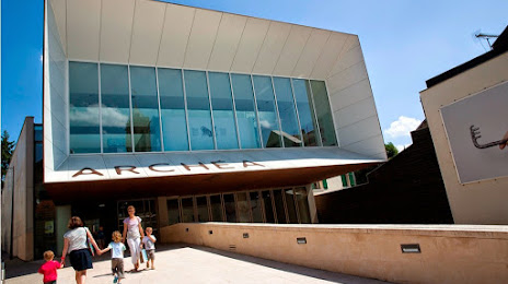
Archéa on the map, Aulnay-sous-Bois, France
Photo
Where is located Archéa
Archéa — local attraction, which is located at 56 Rue de Paris, 95380 Louvres, France and belongs to the category — museum. Average visitor rating for this place — 4.4 (according to 178 ratings, information from open sources and relevant for 2022).
Exact location — Archéa, marked on the map with a red marker.
You can get directions to Archéa on the map from your location.
What else is interesting in Aulnay-sous-Bois? You can see all the sights if you go to the city page.
Coordinates
Archéa, France coordinates in decimal format: latitude — 48.89147090549321, longitude — 2.2930584092126645. When converted to degrees, minutes, seconds Archéa has the following coordinates: 48°53′29.3 north latitude and 2°17′35.01 east longitude.
Nearby cities
The largest cities that are located nearby:
- Boulogne-Billancourt — 22 km
- Amiens — 106 km
- Rouen — 115 km
- Reims — 116 km
- Orléans — 123 km
- Le Havre — 182 km
- Lille — 191 km
- Le Mans — 199 km
- Caen — 209 km
- Charleroi
 (Belgium) — 213 km
 - Tours — 218 km
- Namur (Belgium) — 238 km
- Brussels (Belgium) — 248 km
- Eastbourne
 (United Kingdom) — 254 km
 - Dijon — 262 km
- Metz — 267 km
- Nancy — 271 km
- Angers — 280 km
- Antwerp (Belgium) — 284 km
Distance to the capital
Distance to the capital (Paris) is about — 6 km.