
 Maureville
Samoëns
Gréning
Toulouse
Volx
Goudet
Méhoncourt
Saint-Hymer
Pontcarré
Maureville
Samoëns
Gréning
Toulouse
Volx
Goudet
Méhoncourt
Saint-Hymer
Pontcarré
Tour du Doyenné on the map, Chalon-sur-Saône, France
Photo
Where is located Tour du Doyenné
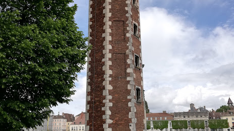
Tour du Doyenné — local attraction, which is located at 2 Quai de l'Hôpital, 71100 Chalon-sur-Saône, France and belongs to the category — historical landmark. Average visitor rating for this place — 4.5 (according to 78 ratings, information from open sources and relevant for 2022).
Exact location — Tour du Doyenné, marked on the map with a red marker.
You can get directions to Tour du Doyenné on the map from your location.
What else is interesting in Chalon-sur-Saône? You can see all the sights if you go to the city page.
Coordinates
Tour du Doyenné, France coordinates in decimal format: latitude — 46.779165416582074, longitude — 4.857177125151379. When converted to degrees, minutes, seconds Tour du Doyenné has the following coordinates: 46°46′45 north latitude and 4°51′25.84 east longitude.
Nearby cities
The largest cities that are located nearby:
- Dijon — 61 km
- Besançon — 101 km
- Villeurbanne — 112 km
- Lyon — 112 km
- Geneva
 (Switzerland) — 118 km
 - Lausanne (Switzerland) — 138 km
- Saint-Étienne — 153 km
- Clermont-Ferrand — 176 km
- Grenoble — 189 km
- Bern (Switzerland) — 196 km
- Mulhouse — 213 km
- Basel (Switzerland) — 222 km
- Nancy — 233 km
- Orléans — 251 km
- Freiburg
 (Germany) — 259 km
 - Metz — 276 km
- Reims — 280 km
- Zurich (Switzerland) — 284 km
- Strasbourg — 290 km
Distance to the capital
Distance to the capital (Paris) is about — 297 km.