
 Maureville
Samoëns
Gréning
Toulouse
Volx
Goudet
Méhoncourt
Saint-Hymer
Pontcarré
Maureville
Samoëns
Gréning
Toulouse
Volx
Goudet
Méhoncourt
Saint-Hymer
Pontcarré
Touloubre (La Touloubre) on the map, Salon-de-Provence, France
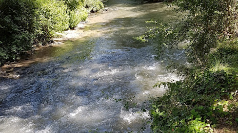
Photo
Where is located Touloubre (La Touloubre)
Touloubre (La Touloubre) — local attraction, which is located at 60 km and belongs to the category — -. Average visitor rating for this place — 4.2 (according to 38 ratings, information from open sources and relevant for 2022).
Exact location — Touloubre (La Touloubre), marked on the map with a red marker.
You can get directions to Touloubre (La Touloubre) on the map from your location.
What else is interesting in Salon-de-Provence? You can see all the sights if you go to the city page.
Coordinates
Touloubre (La Touloubre), France coordinates in decimal format: latitude — 43.573829634695734, longitude — 5.086457875460214. When converted to degrees, minutes, seconds Touloubre (La Touloubre) has the following coordinates: 43°34′25.79 north latitude and 5°5′11.25 east longitude.
Nearby cities
The largest cities that are located nearby:
- Aix-en-Provence — 31 km
- Marseille — 44 km
- Nimes — 63 km
- Toulon — 88 km
- Montpellier — 98 km
- Nice — 173 km
- Grenoble — 178 km
- Saint-Étienne — 206 km
- Perpignan — 208 km
- Lyon — 236 km
- Villeurbanne — 236 km
- Turin
 (Italy) — 257 km
 - Clermont-Ferrand — 283 km
- Toulouse — 292 km
- Geneva
 (Switzerland) — 294 km
 - Genoa (Italy) — 316 km
- Mataró
 (Spain) — 320 km
 - Badalona (Spain) — 339 km
- Novara (Italy) — 339 km
Distance to the capital
Distance to the capital (Paris) is about — 624 km.