
 Maureville
Samoëns
Gréning
Toulouse
Volx
Goudet
Méhoncourt
Saint-Hymer
Pontcarré
Maureville
Samoëns
Gréning
Toulouse
Volx
Goudet
Méhoncourt
Saint-Hymer
Pontcarré
Parc Chapu on the map, Le Mée-sur-Seine, France
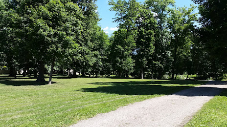
Photo
Where is located Parc Chapu
Parc Chapu — local attraction, which is located at 723 Rue Chapu, 77350 Le Mée-sur-Seine, France and belongs to the category — park. Average visitor rating for this place — 4.3 (according to 152 ratings, information from open sources and relevant for 2022).
Exact location — Parc Chapu, marked on the map with a red marker.
You can get directions to Parc Chapu on the map from your location.
What else is interesting in Le Mée-sur-Seine? You can see all the sights if you go to the city page.
Coordinates
Parc Chapu, France coordinates in decimal format: latitude — 48.53575791070252, longitude — 2.6371464252124195. When converted to degrees, minutes, seconds Parc Chapu has the following coordinates: 48°32′8.73 north latitude and 2°38′13.73 east longitude.
Nearby cities
The largest cities that are located nearby:
- Boulogne-Billancourt — 44 km
- Orléans — 88 km
- Reims — 129 km
- Rouen — 149 km
- Amiens — 152 km
- Le Mans — 189 km
- Tours — 193 km
- Le Havre — 210 km
- Dijon — 225 km
- Caen — 229 km
- Lille — 234 km
- Charleroi
 (Belgium) — 244 km
 - Nancy — 260 km
- Metz — 264 km
- Namur (Belgium) — 266 km
- Angers — 266 km
- Brussels (Belgium) — 283 km
- Besançon — 292 km
- Eastbourne
 (United Kingdom) — 296 km
Distance to the capital
Distance to the capital (Paris) is about — 41 km.