
 Maureville
Samoëns
Gréning
Toulouse
Volx
Goudet
Méhoncourt
Saint-Hymer
Pontcarré
Maureville
Samoëns
Gréning
Toulouse
Volx
Goudet
Méhoncourt
Saint-Hymer
Pontcarré
Le parc de la Plage-Bleue on the map, Villeneuve-Saint-Georges, France
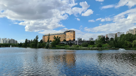
Photo
Where is located Le parc de la Plage-Bleue
Le parc de la Plage-Bleue — local attraction, which is located at no data and belongs to the category — -. Average visitor rating for this place — 4.5 (according to 206 ratings, information from open sources and relevant for 2022).
Exact location — Le parc de la Plage-Bleue, marked on the map with a red marker.
You can get directions to Le parc de la Plage-Bleue on the map from your location.
What else is interesting in Villeneuve-Saint-Georges? You can see all the sights if you go to the city page.
Coordinates
Le parc de la Plage-Bleue, France coordinates in decimal format: latitude — 48.77651990361681, longitude — 2.452532529633081. When converted to degrees, minutes, seconds Le parc de la Plage-Bleue has the following coordinates: 48°46′35.47 north latitude and 2°27′9.12 east longitude.
Nearby cities
The largest cities that are located nearby:
- Boulogne-Billancourt — 19 km
- Orléans — 100 km
- Rouen — 125 km
- Reims — 128 km
- Amiens — 129 km
- Le Mans — 185 km
- Le Havre — 188 km
- Tours — 198 km
- Caen — 210 km
- Lille — 214 km
- Charleroi
 (Belgium) — 233 km
 - Dijon — 249 km
- Namur (Belgium) — 257 km
- Angers — 264 km
- Brussels (Belgium) — 269 km
- Eastbourne
 (United Kingdom) — 271 km
 - Nancy — 273 km
- Metz — 273 km
- Liège (Belgium) — 304 km
Distance to the capital
Distance to the capital (Paris) is about — 12 km.