
 Maureville
Samoëns
Gréning
Toulouse
Volx
Goudet
Méhoncourt
Saint-Hymer
Pontcarré
Maureville
Samoëns
Gréning
Toulouse
Volx
Goudet
Méhoncourt
Saint-Hymer
Pontcarré
Alpilles Natural Regional Park on the map, Saint-Martin-de-Crau, France
Photo
Where is located Alpilles Natural Regional Park
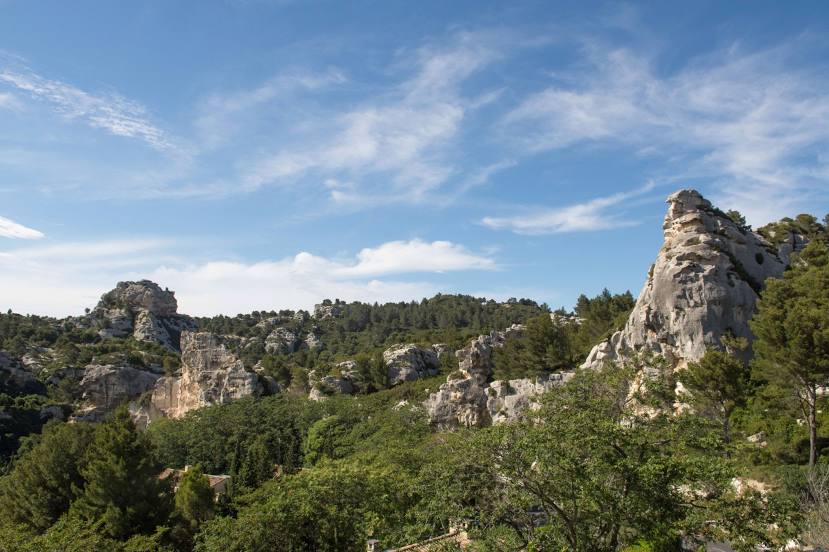
Alpilles Natural Regional Park — local attraction, which is located at 2 Boulevard Marceau, 13210 Saint-Rémy-de-Provence, France and belongs to the category — park. Average visitor rating for this place — 4.6 (according to 7369 ratings, information from open sources and relevant for 2022).
Exact location — Alpilles Natural Regional Park, marked on the map with a red marker.
You can get directions to Alpilles Natural Regional Park on the map from your location.
What else is interesting in Saint-Martin-de-Crau? You can see all the sights if you go to the city page.
Coordinates
Alpilles Natural Regional Park, France coordinates in decimal format: latitude — 43.73463709823827, longitude — 4.889170639695146. When converted to degrees, minutes, seconds Alpilles Natural Regional Park has the following coordinates: 43°44′4.69 north latitude and 4°53′21.01 east longitude.
Nearby cities
The largest cities that are located nearby:
- Nimes — 42 km
- Aix-en-Provence — 52 km
- Marseille — 59 km
- Montpellier — 75 km
- Toulon — 107 km
- Grenoble — 186 km
- Perpignan — 188 km
- Nice — 196 km
- Saint-Étienne — 202 km
- Lyon — 235 km
- Villeurbanne — 236 km
- Toulouse — 270 km
- Clermont-Ferrand — 271 km
- Turin
 (Italy) — 275 km
 - Geneva
 (Switzerland) — 301 km
 - Mataró
 (Spain) — 304 km
 - Sabadell (Spain) — 322 km
- Badalona (Spain) — 322 km
- Santa Coloma de Gramenet (Spain) — 325 km
Distance to the capital
Distance to the capital (Paris) is about — 602 km.