
 Maureville
Samoëns
Gréning
Toulouse
Volx
Goudet
Méhoncourt
Saint-Hymer
Pontcarré
Maureville
Samoëns
Gréning
Toulouse
Volx
Goudet
Méhoncourt
Saint-Hymer
Pontcarré
Cemetery Sainte-Geneviève-des-Bois on the map, Saint-Michel-sur-Orge, France
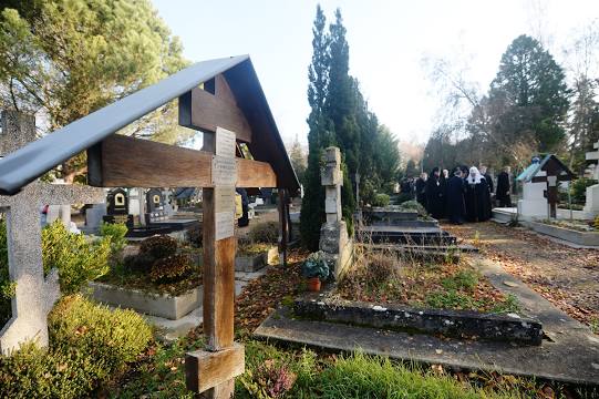
Photo
Where is located Cemetery Sainte-Geneviève-des-Bois
Cemetery Sainte-Geneviève-des-Bois — local attraction, which is located at 4 Rue Léo Lagrange, 91700 Sainte-Geneviève-des-Bois, France and belongs to the category — cemetery. Average visitor rating for this place — 4.8 (according to 37 ratings, information from open sources and relevant for 2022).
Exact location — Cemetery Sainte-Geneviève-des-Bois, marked on the map with a red marker.
You can get directions to Cemetery Sainte-Geneviève-des-Bois on the map from your location.
What else is interesting in Saint-Michel-sur-Orge? You can see all the sights if you go to the city page.
Coordinates
Cemetery Sainte-Geneviève-des-Bois, France coordinates in decimal format: latitude — 48.63102577091219, longitude — 2.3450427252157513. When converted to degrees, minutes, seconds Cemetery Sainte-Geneviève-des-Bois has the following coordinates: 48°37′51.69 north latitude and 2°20′42.15 east longitude.
Nearby cities
The largest cities that are located nearby:
- Boulogne-Billancourt — 24 km
- Orléans — 86 km
- Rouen — 125 km
- Amiens — 139 km
- Reims — 142 km
- Le Mans — 171 km
- Tours — 183 km
- Le Havre — 185 km
- Caen — 203 km
- Lille — 227 km
- Charleroi
 (Belgium) — 247 km
 - Angers — 250 km
- Dijon — 251 km
- Namur (Belgium) — 271 km
- Eastbourne
 (United Kingdom) — 275 km
 - Nancy — 283 km
- Brussels (Belgium) — 284 km
- Metz — 285 km
- Rennes — 300 km
Distance to the capital
Distance to the capital (Paris) is about — 25 km.