
 Maureville
Samoëns
Gréning
Toulouse
Volx
Goudet
Méhoncourt
Saint-Hymer
Pontcarré
Maureville
Samoëns
Gréning
Toulouse
Volx
Goudet
Méhoncourt
Saint-Hymer
Pontcarré
Cultural Park Rentilly - Michel Chartier on the map, Ozoir-la-Ferrière, France
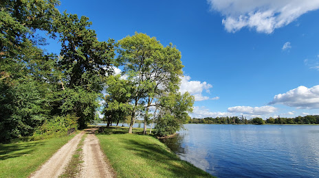
Photo
Where is located Cultural Park Rentilly - Michel Chartier
Cultural Park Rentilly - Michel Chartier — local attraction, which is located at no data and belongs to the category — -. Average visitor rating for this place — 3.2 (according to 10 ratings, information from open sources and relevant for 2022).
Exact location — Cultural Park Rentilly - Michel Chartier, marked on the map with a red marker.
You can get directions to Cultural Park Rentilly - Michel Chartier on the map from your location.
What else is interesting in Ozoir-la-Ferrière? You can see all the sights if you go to the city page.
Coordinates
Cultural Park Rentilly - Michel Chartier, France coordinates in decimal format: latitude — 48.764095455160785, longitude — 2.6831302252204714. When converted to degrees, minutes, seconds Cultural Park Rentilly - Michel Chartier has the following coordinates: 48°45′50.74 north latitude and 2°40′59.27 east longitude.
Nearby cities
The largest cities that are located nearby:
- Boulogne-Billancourt — 33 km
- Orléans — 111 km
- Reims — 112 km
- Amiens — 128 km
- Rouen — 136 km
- Le Havre — 201 km
- Le Mans — 201 km
- Lille — 208 km
- Tours — 212 km
- Charleroi
 (Belgium) — 221 km
 - Caen — 225 km
- Dijon — 239 km
- Namur (Belgium) — 244 km
- Nancy — 257 km
- Metz — 257 km
- Brussels (Belgium) — 259 km
- Eastbourne
 (United Kingdom) — 277 km
 - Angers — 280 km
- Liège (Belgium) — 290 km
Distance to the capital
Distance to the capital (Paris) is about — 26 km.