
 Maureville
Samoëns
Gréning
Toulouse
Volx
Goudet
Méhoncourt
Saint-Hymer
Pontcarré
Maureville
Samoëns
Gréning
Toulouse
Volx
Goudet
Méhoncourt
Saint-Hymer
Pontcarré
Parc de Noisiel on the map, La Queue-en-Brie, France
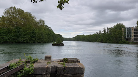
Photo
Where is located Parc de Noisiel
Parc de Noisiel — local attraction, which is located at 1 Cr du Château, 77186 Noisiel, France and belongs to the category — park. Average visitor rating for this place — 4.4 (according to 2532 ratings, information from open sources and relevant for 2022).
Exact location — Parc de Noisiel, marked on the map with a red marker.
You can get directions to Parc de Noisiel on the map from your location.
What else is interesting in La Queue-en-Brie? You can see all the sights if you go to the city page.
Coordinates
Parc de Noisiel, France coordinates in decimal format: latitude — 48.85215381100652, longitude — 2.6186729252235748. When converted to degrees, minutes, seconds Parc de Noisiel has the following coordinates: 48°51′7.75 north latitude and 2°37′7.22 east longitude.
Nearby cities
The largest cities that are located nearby:
- Boulogne-Billancourt — 25 km
- Orléans — 110 km
- Reims — 117 km
- Amiens — 124 km
- Rouen — 128 km
- Le Havre — 194 km
- Le Mans — 196 km
- Lille — 206 km
- Tours — 209 km
- Caen — 217 km
- Charleroi
 (Belgium) — 222 km
 - Namur (Belgium) — 246 km
- Dijon — 246 km
- Brussels (Belgium) — 259 km
- Metz — 263 km
- Nancy — 264 km
- Eastbourne
 (United Kingdom) — 271 km
 - Angers — 276 km
- Liège (Belgium) — 293 km
Distance to the capital
Distance to the capital (Paris) is about — 20 km.