
 Maureville
Samoëns
Gréning
Toulouse
Volx
Goudet
Méhoncourt
Saint-Hymer
Pontcarré
Maureville
Samoëns
Gréning
Toulouse
Volx
Goudet
Méhoncourt
Saint-Hymer
Pontcarré
Giants Garden on the map, Mons-en-Barœul, France
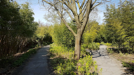
Photo
Where is located Giants Garden
Giants Garden — local attraction, which is located at 1 Rue de la Communauté, 59110 La Madeleine, France and belongs to the category — park. Average visitor rating for this place — 4.4 (according to 1102 ratings, information from open sources and relevant for 2022).
Exact location — Giants Garden, marked on the map with a red marker.
You can get directions to Giants Garden on the map from your location.
What else is interesting in Mons-en-Barœul? You can see all the sights if you go to the city page.
Coordinates
Giants Garden, France coordinates in decimal format: latitude — 50.67296346687178, longitude — 3.086332131890184. When converted to degrees, minutes, seconds Giants Garden has the following coordinates: 50°40′22.67 north latitude and 3°5′10.8 east longitude.
Nearby cities
The largest cities that are located nearby:
- Lille — 4 km
- Brussels
 (Belgium) — 90 km
 - Charleroi (Belgium) — 98 km
- Amiens — 101 km
- Antwerp (Belgium) — 110 km
- Namur (Belgium) — 126 km
- Breda
 (Netherlands) — 155 km
 - Reims — 167 km
- Dordrecht (Netherlands) — 169 km
- Rotterdam (Netherlands) — 170 km
- Tilburg (Netherlands) — 170 km
- Liège (Belgium) — 173 km
- The Hague (Netherlands) — 178 km
- Maastricht (Netherlands) — 182 km
- Zoetermeer (Netherlands) — 183 km
- Eindhoven (Netherlands) — 185 km
- 's-Hertogenbosch (Netherlands) — 190 km
- Leiden (Netherlands) — 192 km
- Southend-on-Sea
 (United Kingdom) — 193 km
Distance to the capital
Distance to the capital (Paris) is about — 209 km.