
 Maureville
Samoëns
Gréning
Toulouse
Volx
Goudet
Méhoncourt
Saint-Hymer
Pontcarré
Maureville
Samoëns
Gréning
Toulouse
Volx
Goudet
Méhoncourt
Saint-Hymer
Pontcarré
Château du diable on the map, Sanary-sur-Mer, France
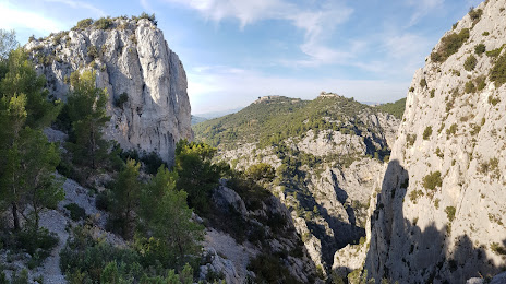
Photo
Where is located Château du diable
Château du diable — local attraction, which is located at Rte des Gorges, 83190 Ollioules, France and belongs to the category — observation deck. Average visitor rating for this place — 4.7 (according to 18 ratings, information from open sources and relevant for 2022).
Exact location — château du diable, marked on the map with a red marker.
You can get directions to Château du diable on the map from your location.
What else is interesting in Sanary-sur-Mer? You can see all the sights if you go to the city page.
Coordinates
château du diable, France coordinates in decimal format: latitude — 43.15359334618678, longitude — 5.846342890458562. When converted to degrees, minutes, seconds château du diable has the following coordinates: 43°9′12.94 north latitude and 5°50′46.83 east longitude.
Nearby cities
The largest cities that are located nearby:
- Toulon — 10 km
- Marseille — 40 km
- Aix-en-Provence — 54 km
- Nice — 134 km
- Nimes — 140 km
- Montpellier — 163 km
- Grenoble — 229 km
- Perpignan — 241 km
- Turin
 (Italy) — 261 km
 - Saint-Étienne — 279 km
- Genoa (Italy) — 286 km
- Villeurbanne — 302 km
- Lyon — 302 km
- Mataró
 (Spain) — 328 km
 - Novara (Italy) — 338 km
- Geneva
 (Switzerland) — 342 km
 - Badalona (Spain) — 348 km
- Santa Coloma de Gramenet (Spain) — 350 km
- Sassari (Italy) — 351 km
Distance to the capital
Distance to the capital (Paris) is about — 689 km.