
 Maureville
Samoëns
Gréning
Toulouse
Volx
Goudet
Méhoncourt
Saint-Hymer
Pontcarré
Maureville
Samoëns
Gréning
Toulouse
Volx
Goudet
Méhoncourt
Saint-Hymer
Pontcarré
Gogottes Garden on the map, Voisins-le-Bretonneux, France
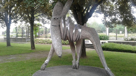
Photo
Where is located Gogottes Garden
Gogottes Garden — local attraction, which is located at 14 Rue Frank Lloyd Wright, 78280 Guyancourt, France and belongs to the category — park. Average visitor rating for this place — 4.1 (according to 121 rating, information from open sources and relevant for 2022).
Exact location — Gogottes Garden, marked on the map with a red marker.
You can get directions to Gogottes Garden on the map from your location.
What else is interesting in Voisins-le-Bretonneux? You can see all the sights if you go to the city page.
Coordinates
Gogottes Garden, France coordinates in decimal format: latitude — 48.765871156286046, longitude — 2.0767842252205186. When converted to degrees, minutes, seconds Gogottes Garden has the following coordinates: 48°45′57.14 north latitude and 2°4′36.42 east longitude.
Nearby cities
The largest cities that are located nearby:
- Boulogne-Billancourt — 17 km
- Orléans — 95 km
- Rouen — 101 km
- Amiens — 127 km
- Reims — 154 km
- Le Mans — 160 km
- Le Havre — 161 km
- Caen — 181 km
- Tours — 182 km
- Lille — 218 km
- Angers — 241 km
- Charleroi
 (Belgium) — 249 km
 - Eastbourne
 (United Kingdom) — 254 km
 - Namur (Belgium) — 274 km
- Dijon — 275 km
- Brussels (Belgium) — 282 km
- Rennes — 284 km
- Metz — 302 km
- Nancy — 302 km
Distance to the capital
Distance to the capital (Paris) is about — 23 km.