
 Maureville
Samoëns
Gréning
Toulouse
Volx
Goudet
Méhoncourt
Saint-Hymer
Pontcarré
Maureville
Samoëns
Gréning
Toulouse
Volx
Goudet
Méhoncourt
Saint-Hymer
Pontcarré
Plaine des Orchidées on the map, Caluire-et-Cuire, France
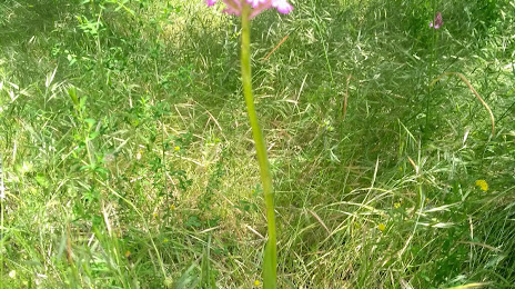
Photo
Where is located Plaine des Orchidées
Plaine des Orchidées — local attraction, which is located at Bd Laurent Bonnevay, 69100 Villeurbanne, France and belongs to the category — city park. Average visitor rating for this place — 4.3 (according to 152 ratings, information from open sources and relevant for 2022).
Exact location — Plaine des Orchidées, marked on the map with a red marker.
You can get directions to Plaine des Orchidées on the map from your location.
What else is interesting in Caluire-et-Cuire? You can see all the sights if you go to the city page.
Coordinates
Plaine des Orchidées, France coordinates in decimal format: latitude — 45.78940711375294, longitude — 4.880919025117787. When converted to degrees, minutes, seconds Plaine des Orchidées has the following coordinates: 45°47′21.87 north latitude and 4°52′51.31 east longitude.
Nearby cities
The largest cities that are located nearby:
- Lyon — 4 km
- Villeurbanne — 5 km
- Saint-Étienne — 53 km
- Grenoble — 96 km
- Geneva
 (Switzerland) — 109 km
 - Clermont-Ferrand — 135 km
- Lausanne (Switzerland) — 158 km
- Dijon — 169 km
- Besançon — 182 km
- Nimes — 220 km
- Bern (Switzerland) — 234 km
- Turin
 (Italy) — 236 km
 - Montpellier — 254 km
- Aix-en-Provence — 255 km
- Limoges — 276 km
- Marseille — 280 km
- Basel (Switzerland) — 284 km
- Mulhouse — 285 km
- Novara (Italy) — 296 km
Distance to the capital
Distance to the capital (Paris) is about — 391 km.