
 Maureville
Samoëns
Gréning
Toulouse
Volx
Goudet
Méhoncourt
Saint-Hymer
Pontcarré
Maureville
Samoëns
Gréning
Toulouse
Volx
Goudet
Méhoncourt
Saint-Hymer
Pontcarré
Domaine Terres Destel on the map, Saint-Raphaël, France
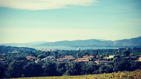
Photo
Where is located Domaine Terres Destel
Domaine Terres Destel — local attraction, which is located at 400 Rue Jean Rostand VALESCURE, 83700 Saint-Raphaël, France and belongs to the category — winery. Average visitor rating for this place — 4.8 (according to 32 ratings, information from open sources and relevant for 2022).
Exact location — Domaine Terres Destel, marked on the map with a red marker.
You can get directions to Domaine Terres Destel on the map from your location.
What else is interesting in Saint-Raphaël? You can see all the sights if you go to the city page.
Coordinates
Domaine Terres Destel, France coordinates in decimal format: latitude — 43.46085643554052, longitude — 6.805951425040923. When converted to degrees, minutes, seconds Domaine Terres Destel has the following coordinates: 43°27′39.08 north latitude and 6°48′21.43 east longitude.
Nearby cities
The largest cities that are located nearby:
- Nice — 50 km
- Toulon — 76 km
- Aix-en-Provence — 107 km
- Marseille — 113 km
- Turin
 (Italy) — 196 km
 - Nimes — 197 km
- Genoa (Italy) — 203 km
- Grenoble — 211 km
- Montpellier — 232 km
- Novara (Italy) — 266 km
- Livorno (Italy) — 284 km
- Saint-Étienne — 289 km
- Milan (Italy) — 293 km
- Villeurbanne — 297 km
- Lyon — 298 km
- Monza (Italy) — 308 km
- Geneva
 (Switzerland) — 310 km
 - Parma (Italy) — 318 km
- Perpignan — 325 km
Distance to the capital
Distance to the capital (Paris) is about — 691 km.