
 Maureville
Samoëns
Gréning
Toulouse
Volx
Goudet
Méhoncourt
Saint-Hymer
Pontcarré
Maureville
Samoëns
Gréning
Toulouse
Volx
Goudet
Méhoncourt
Saint-Hymer
Pontcarré
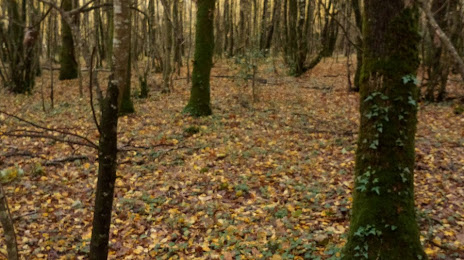
Forêt d'Aizenay on the map, La Roche-sur-Yon, France
Photo
Where is located Forêt d'Aizenay
Forêt d'Aizenay — local attraction, which is located at no data and belongs to the category — -. Average visitor rating for this place — 3.9 (according to 7 ratings, information from open sources and relevant for 2022).
Exact location — Forêt d'Aizenay, marked on the map with a red marker.
You can get directions to Forêt d'Aizenay on the map from your location.
What else is interesting in La Roche-sur-Yon? You can see all the sights if you go to the city page.
Coordinates
Forêt d'Aizenay, France coordinates in decimal format: latitude — 46.73158228117451, longitude — -1.567838101896857. When converted to degrees, minutes, seconds Forêt d'Aizenay has the following coordinates: 46°43′53.7 north latitude and -1°34′4.22 east longitude.
Nearby cities
The largest cities that are located nearby:
- Nantes — 61 km
- Angers — 110 km
- Rennes — 161 km
- Tours — 177 km
- Le Mans — 190 km
- Bordeaux — 213 km
- Limoges — 227 km
- Orléans — 282 km
- Caen — 288 km
- Brest — 294 km
- Le Havre — 331 km
- Rouen — 356 km
- Boulogne-Billancourt — 359 km
- Clermont-Ferrand — 362 km
- San Sebastián
 (Spain) — 373 km
 - Bilbao (Spain) — 396 km
- Santander (Spain) — 403 km
- Toulouse — 410 km
- Pamplona (Spain) — 427 km
Distance to the capital
Distance to the capital (Paris) is about — 376 km.