
 Maureville
Samoëns
Gréning
Toulouse
Volx
Goudet
Méhoncourt
Saint-Hymer
Pontcarré
Maureville
Samoëns
Gréning
Toulouse
Volx
Goudet
Méhoncourt
Saint-Hymer
Pontcarré
La Roseraie on the map, Saint-Étienne-du-Rouvray, France
Photo
Where is located La Roseraie
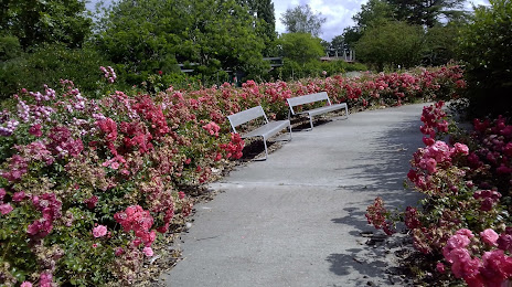
La Roseraie — local attraction, which is located at 36B Rue Adolphe Thiers, 76120 Le Grand-Quevilly, France and belongs to the category — garden. Average visitor rating for this place — 4.3 (according to 635 ratings, information from open sources and relevant for 2022).
Exact location — La Roseraie, marked on the map with a red marker.
You can get directions to La Roseraie on the map from your location.
What else is interesting in Saint-Étienne-du-Rouvray? You can see all the sights if you go to the city page.
Coordinates
La Roseraie, France coordinates in decimal format: latitude — 49.40650166429115, longitude — 1.0559375252432956. When converted to degrees, minutes, seconds La Roseraie has the following coordinates: 49°24′23.41 north latitude and 1°3′21.38 east longitude.
Nearby cities
The largest cities that are located nearby:
- Rouen — 7 km
- Le Havre — 73 km
- Boulogne-Billancourt — 102 km
- Amiens — 102 km
- Caen — 109 km
- Eastbourne
 (United Kingdom) — 164 km
 - Le Mans — 166 km
- Orléans — 174 km
- Lille — 194 km
- Crawley (United Kingdom) — 211 km
- Reims — 211 km
- Portsmouth (United Kingdom) — 221 km
- Tours — 222 km
- Gillingham (United Kingdom) — 225 km
- Sutton (United Kingdom) — 237 km
- Southend-on-Sea (United Kingdom) — 241 km
- Southampton (United Kingdom) — 243 km
- Angers — 245 km
- Basildon (United Kingdom) — 246 km
Distance to the capital
Distance to the capital (Paris) is about — 112 km.