
 Maureville
Samoëns
Gréning
Toulouse
Volx
Goudet
Méhoncourt
Saint-Hymer
Pontcarré
Maureville
Samoëns
Gréning
Toulouse
Volx
Goudet
Méhoncourt
Saint-Hymer
Pontcarré
Saint Jean de Luz Botanical Garden on the map, Saint-Jean-de-Luz, France
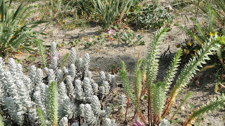
Photo
Where is located Saint Jean de Luz Botanical Garden
Saint Jean de Luz Botanical Garden — local attraction, which is located at 31 Rue Gaëtan de Bernoville, 64500 Saint-Jean-de-Luz, France and belongs to the category — botanical garden. Average visitor rating for this place — 4.1 (according to 469 ratings, information from open sources and relevant for 2022).
Exact location — Saint Jean de Luz Botanical Garden, marked on the map with a red marker.
You can get directions to Saint Jean de Luz Botanical Garden on the map from your location.
What else is interesting in Saint-Jean-de-Luz? You can see all the sights if you go to the city page.
Coordinates
Saint Jean de Luz Botanical Garden, France coordinates in decimal format: latitude — 43.40326030217673, longitude — -1.6501901749609273. When converted to degrees, minutes, seconds Saint Jean de Luz Botanical Garden has the following coordinates: 43°24′11.74 north latitude and -1°39′0.68 east longitude.
Nearby cities
The largest cities that are located nearby:
- San Sebastián
 (Spain) — 27 km
 - Pamplona (Spain) — 64 km
- Vitoria-Gasteiz (Spain) — 101 km
- Bilbao (Spain) — 103 km
- Logroño (Spain) — 121 km
- Santander (Spain) — 172 km
- Bordeaux — 181 km
- Burgos (Spain) — 202 km
- Zaragoza (Spain) — 203 km
- Toulouse — 250 km
- Lleida (Spain) — 272 km
- Valladolid (Spain) — 317 km
- Gijón (Spain) — 321 km
- León (Spain) — 330 km
- Oviedo (Spain) — 337 km
- Tarragona (Spain) — 349 km
- Alcala de Henares (Spain) — 352 km
- Limoges — 352 km
- Alcobendas (Spain) — 356 km
Distance to the capital
Distance to the capital (Paris) is about — 680 km.