
 Maureville
Samoëns
Gréning
Toulouse
Volx
Goudet
Méhoncourt
Saint-Hymer
Pontcarré
Maureville
Samoëns
Gréning
Toulouse
Volx
Goudet
Méhoncourt
Saint-Hymer
Pontcarré
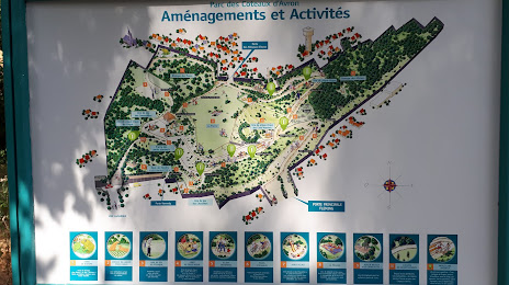
Parc des Côteaux d'Avron on the map, Neuilly-Plaisance, France
Photo
Where is located Parc des Côteaux d'Avron
Parc des Côteaux d'Avron — local attraction, which is located at 3 Chem. des Pelouses d'Avron, 93360 Neuilly-Plaisance, France and belongs to the category — park. Average visitor rating for this place — 4.3 (according to 652 ratings, information from open sources and relevant for 2022).
Exact location — Parc des Côteaux d'Avron, marked on the map with a red marker.
You can get directions to Parc des Côteaux d'Avron on the map from your location.
What else is interesting in Neuilly-Plaisance? You can see all the sights if you go to the city page.
Coordinates
Parc des Côteaux d'Avron, France coordinates in decimal format: latitude — 48.86955922205389, longitude — 2.513704225224195. When converted to degrees, minutes, seconds Parc des Côteaux d'Avron has the following coordinates: 48°52′10.41 north latitude and 2°30′49.34 east longitude.
Nearby cities
The largest cities that are located nearby:
- Boulogne-Billancourt — 20 km
- Amiens — 115 km
- Orléans — 115 km
- Reims — 118 km
- Rouen — 120 km
- Le Havre — 186 km
- Le Mans — 195 km
- Lille — 199 km
- Caen — 211 km
- Tours — 212 km
- Charleroi
 (Belgium) — 219 km
 - Namur (Belgium) — 243 km
- Brussels (Belgium) — 254 km
- Dijon — 255 km
- Eastbourne
 (United Kingdom) — 261 km
 - Metz — 267 km
- Nancy — 269 km
- Angers — 276 km
- Liège (Belgium) — 291 km
Distance to the capital
Distance to the capital (Paris) is about — 12 km.