
 Maureville
Samoëns
Gréning
Toulouse
Volx
Goudet
Méhoncourt
Saint-Hymer
Pontcarré
Maureville
Samoëns
Gréning
Toulouse
Volx
Goudet
Méhoncourt
Saint-Hymer
Pontcarré
Parc du Croissant Vert on the map, Neuilly-Plaisance, France
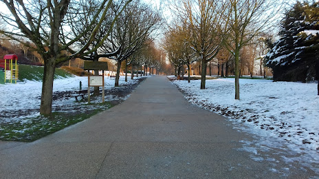
Photo
Where is located Parc du Croissant Vert
Parc du Croissant Vert — local attraction, which is located at 116bis Rue Hippolyte Pina, 93220 Gagny, France and belongs to the category — city park. Average visitor rating for this place — 4.5 (according to 0 ratings, information from open sources and relevant for 2022).
Exact location — Parc du Croissant Vert, marked on the map with a red marker.
You can get directions to Parc du Croissant Vert on the map from your location.
What else is interesting in Neuilly-Plaisance? You can see all the sights if you go to the city page.
Coordinates
Parc du Croissant Vert, France coordinates in decimal format: latitude — 48.983401182457605, longitude — 2.5307692678763494. When converted to degrees, minutes, seconds Parc du Croissant Vert has the following coordinates: 48°59′0.24 north latitude and 2°31′50.77 east longitude.
Nearby cities
The largest cities that are located nearby:
- Boulogne-Billancourt — 20 km
- Amiens — 115 km
- Orléans — 115 km
- Reims — 118 km
- Rouen — 120 km
- Le Havre — 186 km
- Le Mans — 195 km
- Lille — 199 km
- Caen — 211 km
- Tours — 212 km
- Charleroi
 (Belgium) — 219 km
 - Namur (Belgium) — 243 km
- Brussels (Belgium) — 254 km
- Dijon — 255 km
- Eastbourne
 (United Kingdom) — 261 km
 - Metz — 267 km
- Nancy — 269 km
- Angers — 276 km
- Liège (Belgium) — 291 km
Distance to the capital
Distance to the capital (Paris) is about — 19 km.