
Other locations
Sainte-Gemmes-sur-Loire  Maureville
Samoëns
Gréning
Toulouse
Volx
Goudet
Méhoncourt
Saint-Hymer
Pontcarré
Maureville
Samoëns
Gréning
Toulouse
Volx
Goudet
Méhoncourt
Saint-Hymer
Pontcarré
Luy on the map, Dax, France
Comments
Where is located Luy on the map, Dax, France. Geographic coordinates in decimal format, as well as degrees, minutes and seconds. Photo, address and average rating of visitors who have been here.
Photo
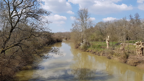
Where is located Luy
Luy — local attraction, which is located at 155 km and belongs to the category — -. Average visitor rating for this place — 4.6 (according to 21 rating, information from open sources and relevant for 2022).
Exact location — Luy, marked on the map with a red marker.
You can get directions to Luy on the map from your location.
What else is interesting in Dax? You can see all the sights if you go to the city page.
Coordinates
Luy, France coordinates in decimal format: latitude — 43.648722293661265, longitude — -0.957360660996425. When converted to degrees, minutes, seconds Luy has the following coordinates: 43°38′55.4 north latitude and -0°57′26.5 east longitude.
Nearby cities
The largest cities that are located nearby:
- San Sebastián
 (Spain) — 86 km
 - Pamplona (Spain) — 110 km
- Bordeaux — 130 km
- Bilbao (Spain) — 159 km
- Vitoria-Gasteiz (Spain) — 162 km
- Logroño (Spain) — 179 km
- Toulouse — 200 km
- Santander (Spain) — 223 km
- Zaragoza (Spain) — 228 km
- Burgos (Spain) — 264 km
- Lleida (Spain) — 269 km
- Limoges — 295 km
- Perpignan — 340 km
- Tarragona (Spain) — 344 km
- Terrassa (Spain) — 347 km
- Sabadell (Spain) — 354 km
- Santa Coloma de Gramenet (Spain) — 368 km
- L'Hospitalet de Llobregat (Spain) — 369 km
- Gijón (Spain) — 370 km
Distance to the capital
Distance to the capital (Paris) is about — 633 km.