
 Maureville
Samoëns
Gréning
Toulouse
Volx
Goudet
Méhoncourt
Saint-Hymer
Pontcarré
Maureville
Samoëns
Gréning
Toulouse
Volx
Goudet
Méhoncourt
Saint-Hymer
Pontcarré
Parc du Grand Large on the map, Décines-Charpieu, France
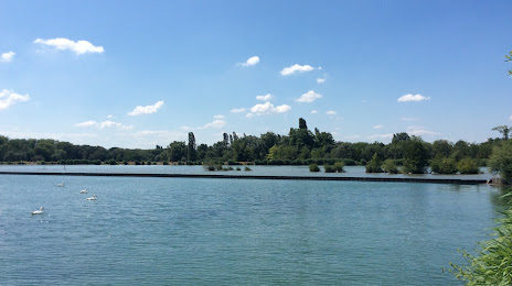
Photo
Where is located Parc du Grand Large
Parc du Grand Large — local attraction, which is located at 12 Rue Surcouf, 69330 Meyzieu, France and belongs to the category — city park. Average visitor rating for this place — 4.4 (according to 215 ratings, information from open sources and relevant for 2022).
Exact location — Parc du Grand Large, marked on the map with a red marker.
You can get directions to Parc du Grand Large on the map from your location.
What else is interesting in Décines-Charpieu? You can see all the sights if you go to the city page.
Coordinates
Parc du Grand Large, France coordinates in decimal format: latitude — 45.78387995438586, longitude — 4.978984002822488. When converted to degrees, minutes, seconds Parc du Grand Large has the following coordinates: 45°47′1.97 north latitude and 4°58′44.34 east longitude.
Nearby cities
The largest cities that are located nearby:
- Villeurbanne — 5 km
- Lyon — 9 km
- Saint-Étienne — 57 km
- Grenoble — 88 km
- Geneva
 (Switzerland) — 102 km
 - Clermont-Ferrand — 144 km
- Lausanne (Switzerland) — 152 km
- Dijon — 172 km
- Besançon — 181 km
- Nimes — 219 km
- Turin
 (Italy) — 227 km
 - Bern (Switzerland) — 229 km
- Aix-en-Provence — 250 km
- Montpellier — 254 km
- Marseille — 275 km
- Basel (Switzerland) — 280 km
- Mulhouse — 282 km
- Limoges — 285 km
- Novara (Italy) — 287 km
Distance to the capital
Distance to the capital (Paris) is about — 395 km.