
 Maureville
Samoëns
Gréning
Toulouse
Volx
Goudet
Méhoncourt
Saint-Hymer
Pontcarré
Maureville
Samoëns
Gréning
Toulouse
Volx
Goudet
Méhoncourt
Saint-Hymer
Pontcarré
TROPICALAND on the map, Saint-Julien-en-Genevois, France
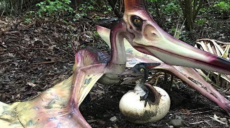
Photo
Where is located TROPICALAND
TROPICALAND — local attraction, which is located at 50 Chem. de Cortenet, 74580 Viry, France and belongs to the category — theme park. Average visitor rating for this place — 3.4 (according to 305 ratings, information from open sources and relevant for 2022).
Exact location — TROPICALAND, marked on the map with a red marker.
You can get directions to TROPICALAND on the map from your location.
What else is interesting in Saint-Julien-en-Genevois? You can see all the sights if you go to the city page.
Coordinates
TROPICALAND, France coordinates in decimal format: latitude — 46.13021752020162, longitude — 6.0493676251293005. When converted to degrees, minutes, seconds TROPICALAND has the following coordinates: 46°7′48.78 north latitude and 6°2′57.72 east longitude.
Nearby cities
The largest cities that are located nearby:
- Geneva
 (Switzerland) — 8 km
 - Lausanne (Switzerland) — 59 km
- Villeurbanne — 101 km
- Lyon — 105 km
- Grenoble — 109 km
- Besançon — 121 km
- Bern (Switzerland) — 136 km
- Dijon — 152 km
- Saint-Étienne — 153 km
- Turin
 (Italy) — 173 km
 - Basel (Switzerland) — 194 km
- Mulhouse — 201 km
- Novara (Italy) — 212 km
- Zurich (Switzerland) — 228 km
- Clermont-Ferrand — 234 km
- Freiburg
 (Germany) — 243 km
 - Milan (Italy) — 252 km
- Monza (Italy) — 255 km
- Nancy — 282 km
Distance to the capital
Distance to the capital (Paris) is about — 411 km.