
 Maureville
Samoëns
Gréning
Toulouse
Volx
Goudet
Méhoncourt
Saint-Hymer
Pontcarré
Maureville
Samoëns
Gréning
Toulouse
Volx
Goudet
Méhoncourt
Saint-Hymer
Pontcarré
Lac de St-Caprais (Lac de Saint-Caprais) on the map, L'Union, France
Photo
Where is located Lac de St-Caprais (Lac de Saint-Caprais)
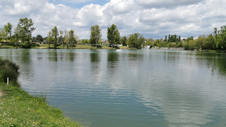
Lac de St-Caprais (Lac de Saint-Caprais) — local attraction, which is located at 31240 L'Union, France and belongs to the category — fishing pond. Average visitor rating for this place — 4.3 (according to 284 ratings, information from open sources and relevant for 2022).
Exact location — Lac de St-Caprais (Lac de Saint-Caprais), marked on the map with a red marker.
You can get directions to Lac de St-Caprais (Lac de Saint-Caprais) on the map from your location.
What else is interesting in L'Union? You can see all the sights if you go to the city page.
Coordinates
Lac de St-Caprais (Lac de Saint-Caprais), France coordinates in decimal format: latitude — 43.64487884237699, longitude — 1.4820576250469046. When converted to degrees, minutes, seconds Lac de St-Caprais (Lac de Saint-Caprais) has the following coordinates: 43°38′41.56 north latitude and 1°28′55.41 east longitude.
Nearby cities
The largest cities that are located nearby:
- Toulouse — 7 km
- Perpignan — 157 km
- Montpellier — 192 km
- Bordeaux — 208 km
- Nimes — 230 km
- Terrassa
 (Spain) — 236 km
 - Lleida (Spain) — 237 km
- Sabadell (Spain) — 239 km
- Limoges — 241 km
- Mataró (Spain) — 247 km
- Santa Coloma de Gramenet (Spain) — 252 km
- Badalona (Spain) — 252 km
- L'Hospitalet de Llobregat (Spain) — 259 km
- Clermont-Ferrand — 265 km
- Pamplona (Spain) — 270 km
- San Sebastián (Spain) — 281 km
- Tarragona (Spain) — 281 km
- Zaragoza (Spain) — 296 km
- Saint-Étienne — 299 km
Distance to the capital
Distance to the capital (Paris) is about — 584 km.