
 Maureville
Samoëns
Gréning
Toulouse
Volx
Goudet
Méhoncourt
Saint-Hymer
Pontcarré
Maureville
Samoëns
Gréning
Toulouse
Volx
Goudet
Méhoncourt
Saint-Hymer
Pontcarré
Cave Touristique des Vignerons on the map, Montlouis-sur-Loire, France
Photo
Where is located Cave Touristique des Vignerons
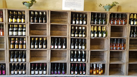
Cave Touristique des Vignerons — local attraction, which is located at 2 Place, Rue Abraham Courtemanche, 37270 Montlouis-sur-Loire, France and belongs to the category — winery. Average visitor rating for this place — 4.1 (according to 20 ratings, information from open sources and relevant for 2022).
Exact location — Cave Touristique des Vignerons, marked on the map with a red marker.
You can get directions to Cave Touristique des Vignerons on the map from your location.
What else is interesting in Montlouis-sur-Loire? You can see all the sights if you go to the city page.
Coordinates
Cave Touristique des Vignerons, France coordinates in decimal format: latitude — 47.39030579375827, longitude — 0.8311519251724538. When converted to degrees, minutes, seconds Cave Touristique des Vignerons has the following coordinates: 47°23′25.1 north latitude and 0°49′52.15 east longitude.
Nearby cities
The largest cities that are located nearby:
- Tours — 11 km
- Le Mans — 83 km
- Orléans — 98 km
- Angers — 104 km
- Limoges — 175 km
- Nantes — 180 km
- Boulogne-Billancourt — 191 km
- Rennes — 202 km
- Caen — 216 km
- Rouen — 228 km
- Le Havre — 239 km
- Clermont-Ferrand — 249 km
- Amiens — 296 km
- Bordeaux — 303 km
- Reims — 310 km
- Dijon — 316 km
- Saint-Étienne — 350 km
- Lyon — 358 km
- Villeurbanne — 361 km
Distance to the capital
Distance to the capital (Paris) is about — 198 km.