
 Maureville
Samoëns
Gréning
Toulouse
Volx
Goudet
Méhoncourt
Saint-Hymer
Pontcarré
Maureville
Samoëns
Gréning
Toulouse
Volx
Goudet
Méhoncourt
Saint-Hymer
Pontcarré
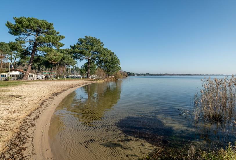
Étang de Cazaux et de Sanguinet on the map, La Teste-de-Buch, France
Photo
Where is located Étang de Cazaux et de Sanguinet
Étang de Cazaux et de Sanguinet — local attraction, which is located at 55 km² and belongs to the category — -. Average visitor rating for this place — 4.5 (according to 150 ratings, information from open sources and relevant for 2022).
Exact location — Étang de Cazaux et de Sanguinet, marked on the map with a red marker.
You can get directions to Étang de Cazaux et de Sanguinet on the map from your location.
What else is interesting in La Teste-de-Buch? You can see all the sights if you go to the city page.
Coordinates
Étang de Cazaux et de Sanguinet, France coordinates in decimal format: latitude — 44.487778170900285, longitude — -1.1599595067465795. When converted to degrees, minutes, seconds Étang de Cazaux et de Sanguinet has the following coordinates: 44°29′16 north latitude and -1°9′35.85 east longitude.
Nearby cities
The largest cities that are located nearby:
- Bordeaux — 50 km
- San Sebastián
 (Spain) — 160 km
 - Pamplona (Spain) — 205 km
- Bilbao (Spain) — 209 km
- Limoges — 228 km
- Vitoria-Gasteiz (Spain) — 232 km
- Toulouse — 237 km
- Santander (Spain) — 250 km
- Logroño (Spain) — 262 km
- Nantes — 288 km
- Angers — 318 km
- Burgos (Spain) — 328 km
- Zaragoza (Spain) — 330 km
- Tours — 335 km
- Clermont-Ferrand — 350 km
- Lleida (Spain) — 364 km
- Gijón (Spain) — 382 km
- Le Mans — 386 km
- Rennes — 387 km
Distance to the capital
Distance to the capital (Paris) is about — 555 km.