
 Maureville
Samoëns
Gréning
Toulouse
Volx
Goudet
Méhoncourt
Saint-Hymer
Pontcarré
Maureville
Samoëns
Gréning
Toulouse
Volx
Goudet
Méhoncourt
Saint-Hymer
Pontcarré
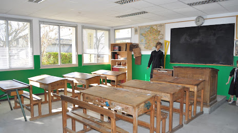
Musée de l'École d'Autrefois on the map, L'Isle-sur-la-Sorgue, France
Photo
Where is located Musée de l'École d'Autrefois
Musée de l'École d'Autrefois — local attraction, which is located at 54 Chem. de l'École de Saint-Antoine, 84800 L'Isle-sur-la-Sorgue, France and belongs to the category — museum. Average visitor rating for this place — 4.5 (according to 24 ratings, information from open sources and relevant for 2022).
Exact location — Musée de l'École d'Autrefois, marked on the map with a red marker.
You can get directions to Musée de l'École d'Autrefois on the map from your location.
What else is interesting in L'Isle-sur-la-Sorgue? You can see all the sights if you go to the city page.
Coordinates
Musée de l'École d'Autrefois, France coordinates in decimal format: latitude — 43.935449711806626, longitude — 5.065944825056352. When converted to degrees, minutes, seconds Musée de l'École d'Autrefois has the following coordinates: 43°56′7.62 north latitude and 5°3′57.4 east longitude.
Nearby cities
The largest cities that are located nearby:
- Aix-en-Provence — 53 km
- Nimes — 56 km
- Marseille — 73 km
- Montpellier — 100 km
- Toulon — 112 km
- Grenoble — 150 km
- Saint-Étienne — 176 km
- Nice — 178 km
- Lyon — 205 km
- Villeurbanne — 206 km
- Perpignan — 222 km
- Turin
 (Italy) — 242 km
 - Clermont-Ferrand — 256 km
- Geneva
 (Switzerland) — 266 km
 - Toulouse — 291 km
- Genoa (Italy) — 312 km
- Lausanne (Switzerland) — 312 km
- Novara (Italy) — 324 km
- Mataró
 (Spain) — 340 km
Distance to the capital
Distance to the capital (Paris) is about — 586 km.