
 Maureville
Samoëns
Gréning
Toulouse
Volx
Goudet
Méhoncourt
Saint-Hymer
Pontcarré
Maureville
Samoëns
Gréning
Toulouse
Volx
Goudet
Méhoncourt
Saint-Hymer
Pontcarré
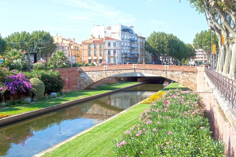
Têt on the map, Canet-en-Roussillon, France
Photo
Where is located Têt
Têt — local attraction, which is located at Mediterranean Sea and belongs to the category — -. Average visitor rating for this place — 4.5 (according to 71 rating, information from open sources and relevant for 2022).
Exact location — Têt, marked on the map with a red marker.
You can get directions to Têt on the map from your location.
What else is interesting in Canet-en-Roussillon? You can see all the sights if you go to the city page.
Coordinates
Têt, France coordinates in decimal format: latitude — 42.68031173511405, longitude — 3.0010105264492632. When converted to degrees, minutes, seconds Têt has the following coordinates: 42°40′49.12 north latitude and 3°0′3.64 east longitude.
Nearby cities
The largest cities that are located nearby:
- Perpignan — 10 km
- Montpellier — 122 km
- Mataró
 (Spain) — 137 km
 - Sabadell (Spain) — 148 km
- Terrassa (Spain) — 151 km
- Badalona (Spain) — 153 km
- Santa Coloma de Gramenet (Spain) — 154 km
- Toulouse — 160 km
- Nimes — 165 km
- L'Hospitalet de Llobregat (Spain) — 166 km
- Marseille — 201 km
- Aix-en-Provence — 216 km
- Tarragona (Spain) — 229 km
- Lleida (Spain) — 231 km
- Toulon — 240 km
- Saint-Étienne — 321 km
- Clermont-Ferrand — 340 km
- Zaragoza (Spain) — 343 km
- Grenoble — 347 km
Distance to the capital
Distance to the capital (Paris) is about — 689 km.