
 Maureville
Samoëns
Gréning
Toulouse
Volx
Goudet
Méhoncourt
Saint-Hymer
Pontcarré
Maureville
Samoëns
Gréning
Toulouse
Volx
Goudet
Méhoncourt
Saint-Hymer
Pontcarré
Parc Pasteur on the map, Orléans, France
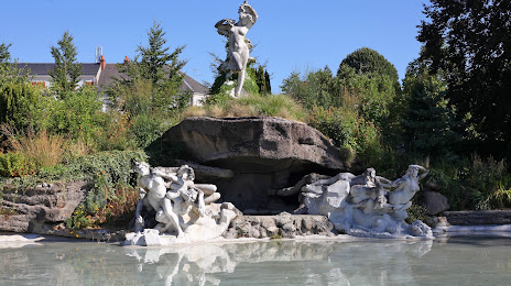
Photo
Where is located Parc Pasteur
Parc Pasteur — local attraction, which is located at 10 Rue Pierre Premier de Serbie, 45000 Orléans, France and belongs to the category — park. Average visitor rating for this place — 4.4 (according to 1911 ratings, information from open sources and relevant for 2022).
Exact location — Parc Pasteur, marked on the map with a red marker.
You can get directions to Parc Pasteur on the map from your location.
What else is interesting in Orléans? You can see all the sights if you go to the city page.
Coordinates
Parc Pasteur, France coordinates in decimal format: latitude — 47.906914515501995, longitude — 1.911226875190377. When converted to degrees, minutes, seconds Parc Pasteur has the following coordinates: 47°54′24.89 north latitude and 1°54′40.42 east longitude.
Nearby cities
The largest cities that are located nearby:
- Boulogne-Billancourt — 106 km
- Tours — 108 km
- Le Mans — 127 km
- Rouen — 180 km
- Angers — 191 km
- Reims — 214 km
- Caen — 217 km
- Le Havre — 218 km
- Amiens — 222 km
- Limoges — 234 km
- Dijon — 243 km
- Clermont-Ferrand — 252 km
- Rennes — 266 km
- Nantes — 271 km
- Lille — 312 km
- Besançon — 318 km
- Nancy — 324 km
- Lyon — 327 km
- Villeurbanne — 329 km
Distance to the capital
Distance to the capital (Paris) is about — 111 km.