
 Maureville
Samoëns
Gréning
Toulouse
Volx
Goudet
Méhoncourt
Saint-Hymer
Pontcarré
Maureville
Samoëns
Gréning
Toulouse
Volx
Goudet
Méhoncourt
Saint-Hymer
Pontcarré
À L'Écu De France on the map, Ville-d'Avray, France
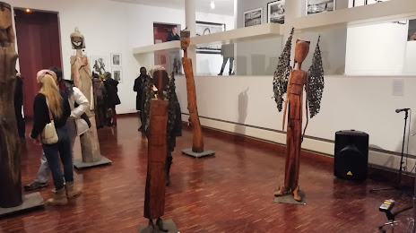
Photo
Where is located À L'Écu De France
À L'Écu De France — local attraction, which is located at 76 Av. du Général Leclerc, 78220 Viroflay, France and belongs to the category — museum. Average visitor rating for this place — 4.8 (according to 31 rating, information from open sources and relevant for 2022).
Exact location — À L'Écu De France, marked on the map with a red marker.
You can get directions to À L'Écu De France on the map from your location.
What else is interesting in Ville-d'Avray? You can see all the sights if you go to the city page.
Coordinates
À L'Écu De France, France coordinates in decimal format: latitude — 48.79807065507556, longitude — 2.3459951166117854. When converted to degrees, minutes, seconds À L'Écu De France has the following coordinates: 48°47′53.05 north latitude and 2°20′45.58 east longitude.
Nearby cities
The largest cities that are located nearby:
- Boulogne-Billancourt — 4 km
- Rouen — 104 km
- Orléans — 104 km
- Amiens — 118 km
- Reims — 141 km
- Le Havre — 167 km
- Le Mans — 173 km
- Caen — 189 km
- Tours — 194 km
- Lille — 208 km
- Charleroi
 (Belgium) — 236 km
 - Eastbourne
 (United Kingdom) — 252 km
 - Angers — 254 km
- Namur (Belgium) — 262 km
- Brussels (Belgium) — 270 km
- Dijon — 271 km
- Metz — 290 km
- Nancy — 292 km
- Rennes — 296 km
Distance to the capital
Distance to the capital (Paris) is about — 7 km.