
 Maureville
Samoëns
Gréning
Toulouse
Volx
Goudet
Méhoncourt
Saint-Hymer
Pontcarré
Maureville
Samoëns
Gréning
Toulouse
Volx
Goudet
Méhoncourt
Saint-Hymer
Pontcarré
Parc du Tremblay on the map, Le Perreux-sur-Marne, France
Photo
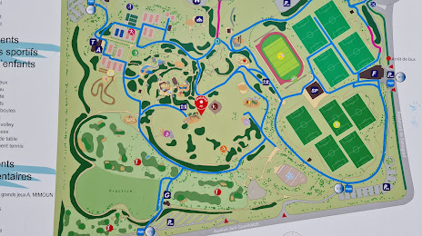
Where is located Parc du Tremblay
Parc du Tremblay — local attraction, which is located at 11 Bd des Alliés, 94500 Champigny-sur-Marne, France and belongs to the category — park. Average visitor rating for this place — 4.3 (according to 3849 ratings, information from open sources and relevant for 2022).
Exact location — Parc du Tremblay, marked on the map with a red marker.
You can get directions to Parc du Tremblay on the map from your location.
What else is interesting in Le Perreux-sur-Marne? You can see all the sights if you go to the city page.
Coordinates
Parc du Tremblay, France coordinates in decimal format: latitude — 48.825829894304256, longitude — 2.4876722252226546. When converted to degrees, minutes, seconds Parc du Tremblay has the following coordinates: 48°49′32.99 north latitude and 2°29′15.62 east longitude.
Nearby cities
The largest cities that are located nearby:
- Boulogne-Billancourt — 19 km
- Orléans — 113 km
- Amiens — 117 km
- Reims — 119 km
- Rouen — 121 km
- Le Havre — 187 km
- Le Mans — 194 km
- Lille — 201 km
- Tours — 210 km
- Caen — 211 km
- Charleroi
 (Belgium) — 221 km
 - Namur (Belgium) — 245 km
- Dijon — 254 km
- Brussels (Belgium) — 257 km
- Eastbourne
 (United Kingdom) — 263 km
 - Metz — 267 km
- Nancy — 269 km
- Angers — 274 km
- Liège (Belgium) — 293 km
Distance to the capital
Distance to the capital (Paris) is about — 10 km.