
 Zelfana
Balloul
أحمد سالم كركرة
Ouargla Province
Boumaiza
Constantine
Frane
Ain Arko
Corso
Zelfana
Balloul
أحمد سالم كركرة
Ouargla Province
Boumaiza
Constantine
Frane
Ain Arko
Corso
Plage de L'Hôtel Sheraton on the map, Zeralda, Algeria
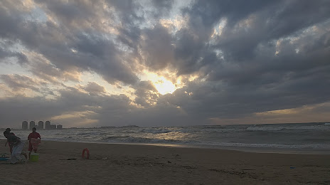
Photo
Where is located Plage de L'Hôtel Sheraton
Plage de L'Hôtel Sheraton — local attraction, which is located at no data and belongs to the category — -. Average visitor rating for this place — 3.9 (according to 16 ratings, information from open sources and relevant for 2022).
Exact location — Plage de L'Hôtel Sheraton, marked on the map with a red marker.
You can get directions to Plage de L'Hôtel Sheraton on the map from your location.
What else is interesting in Zeralda? You can see all the sights if you go to the city page.
Coordinates
Plage de L'Hôtel Sheraton, Algeria coordinates in decimal format: latitude — 36.764462402915505, longitude — 2.872259674838291. When converted to degrees, minutes, seconds Plage de L'Hôtel Sheraton has the following coordinates: 36°45′52.06 north latitude and 2°52′20.13 east longitude.
Nearby cities
The largest cities that are located nearby:
- Algiers — 20 km
- Médéa — 48 km
- Chlef — 146 km
- Bou Arreridj Bordj — 186 km
- M'Sila — 191 km
- Bejaia — 198 km
- Relizane — 230 km
- Setif — 237 km
- Saida — 318 km
- Palma
 (Spain) — 318 km
 - Laghouat — 320 km
- Batna — 326 km
- Oran — 330 km
- Constantine — 338 km
- Cartagena (Spain) — 350 km
- Sidi Bel Abbes — 354 km
- Skikda — 361 km
- Murcia (Spain) — 374 km
- Guelma — 410 km