
 Maureville
Samoëns
Gréning
Toulouse
Volx
Goudet
Méhoncourt
Saint-Hymer
Pontcarré
Maureville
Samoëns
Gréning
Toulouse
Volx
Goudet
Méhoncourt
Saint-Hymer
Pontcarré
Bambous en Provence on the map, Châteaurenard, France
Photo
Where is located Bambous en Provence
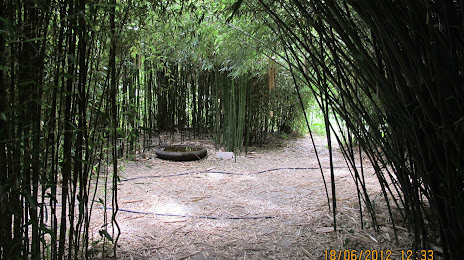
Bambous en Provence — local attraction, which is located at 2388 Cd 29 Route de Graveson petit mas de l'hermite, 13630 Eyragues, France and belongs to the category — botanical garden. Average visitor rating for this place — 4.8 (according to 113 ratings, information from open sources and relevant for 2022).
Exact location — Bambous en Provence, marked on the map with a red marker.
You can get directions to Bambous en Provence on the map from your location.
What else is interesting in Châteaurenard? You can see all the sights if you go to the city page.
Coordinates
Bambous en Provence, France coordinates in decimal format: latitude — 43.846486291029855, longitude — 4.810263924958856. When converted to degrees, minutes, seconds Bambous en Provence has the following coordinates: 43°50′47.35 north latitude and 4°48′36.95 east longitude.
Nearby cities
The largest cities that are located nearby:
- Nimes — 40 km
- Aix-en-Provence — 61 km
- Marseille — 77 km
- Montpellier — 84 km
- Toulon — 120 km
- Grenoble — 160 km
- Saint-Étienne — 176 km
- Nice — 193 km
- Perpignan — 207 km
- Lyon — 208 km
- Villeurbanne — 209 km
- Clermont-Ferrand — 250 km
- Turin
 (Italy) — 257 km
 - Geneva
 (Switzerland) — 274 km
 - Toulouse — 275 km
- Lausanne (Switzerland) — 321 km
- Mataró
 (Spain) — 327 km
 - Genoa (Italy) — 328 km
- Novara (Italy) — 340 km
Distance to the capital
Distance to the capital (Paris) is about — 588 km.