
 Maureville
Samoëns
Gréning
Toulouse
Volx
Goudet
Méhoncourt
Saint-Hymer
Pontcarré
Maureville
Samoëns
Gréning
Toulouse
Volx
Goudet
Méhoncourt
Saint-Hymer
Pontcarré
Chapelle Sainte-Rita on the map, Bagneux, France
Photo
Where is located Chapelle Sainte-Rita
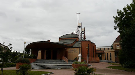
Chapelle Sainte-Rita — local attraction, which is located at 7 Rue Gentil Bernard, 92260 Fontenay-aux-Roses, France and belongs to the category — chapel. Average visitor rating for this place — 4.7 (according to 67 ratings, information from open sources and relevant for 2022).
Exact location — Chapelle Sainte-Rita, marked on the map with a red marker.
You can get directions to Chapelle Sainte-Rita on the map from your location.
What else is interesting in Bagneux? You can see all the sights if you go to the city page.
Coordinates
Chapelle Sainte-Rita, France coordinates in decimal format: latitude — 48.8343857097624, longitude — 2.3096655597404783. When converted to degrees, minutes, seconds Chapelle Sainte-Rita has the following coordinates: 48°50′3.79 north latitude and 2°18′34.8 east longitude.
Nearby cities
The largest cities that are located nearby:
- Boulogne-Billancourt — 7 km
- Orléans — 103 km
- Rouen — 113 km
- Amiens — 121 km
- Reims — 134 km
- Le Havre — 176 km
- Le Mans — 179 km
- Tours — 197 km
- Caen — 198 km
- Lille — 209 km
- Charleroi
 (Belgium) — 233 km
 - Namur (Belgium) — 258 km
- Angers — 260 km
- Eastbourne
 (United Kingdom) — 260 km
 - Dijon — 262 km
- Brussels (Belgium) — 268 km
- Metz — 282 km
- Nancy — 283 km
- Rennes — 304 km
Distance to the capital
Distance to the capital (Paris) is about — 4 km.