
 Acajutla
Santiago de la Frontera
Ostuma
Caluco
El Carbonal
San Luis De La Reina
Residencial Las Arboledas
Pasaquina
Planes de Renderos
Acajutla
Santiago de la Frontera
Ostuma
Caluco
El Carbonal
San Luis De La Reina
Residencial Las Arboledas
Pasaquina
Planes de Renderos
Guazapa on the map, Guazapa, El Salvador
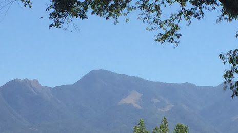
Photo
Where is located Guazapa
Guazapa — local attraction, which is located at 1,438 m and belongs to the category — -. Average visitor rating for this place — 4.2 (according to 17 ratings, information from open sources and relevant for 2022).
Exact location — Guazapa, marked on the map with a red marker.
You can get directions to Guazapa on the map from your location.
What else is interesting in Guazapa? You can see all the sights if you go to the city page.
Coordinates
Guazapa, El Salvador coordinates in decimal format: latitude — 13.875242496656622, longitude — -89.1756021521775. When converted to degrees, minutes, seconds Guazapa has the following coordinates: 13°52′30.87 north latitude and -89°10′32.17 east longitude.
Nearby cities
The largest cities that are located nearby:
- Apopa — 7 km
- Mejicanos — 16 km
- Soyapango — 19 km
- Santa Tecla — 25 km
- Santa Ana — 43 km
- San Miguel — 116 km
- Villa Canales
 (Guatemala) — 158 km
 - Guatemala City (Guatemala) — 167 km
- Villa Nueva (Guatemala) — 168 km
- Escuintla (Guatemala) — 179 km
- San Juan Sacatepéquez (Guatemala) — 183 km
- Tegucigalpa
 (Honduras) — 211 km
 - San Pedro Sula (Honduras) — 217 km
- El Progreso (Honduras) — 223 km
- Choloma (Honduras) — 231 km
- Chinandega
 (Nicaragua) — 261 km
 - Quetzaltenango (Guatemala) — 272 km
- Lion (Nicaragua) — 295 km
- La Ceiba (Honduras) — 325 km
Distance to the capital
Distance to the capital (San Salvador) is about — 21 km.