
 Maureville
Samoëns
Gréning
Toulouse
Volx
Goudet
Méhoncourt
Saint-Hymer
Pontcarré
Maureville
Samoëns
Gréning
Toulouse
Volx
Goudet
Méhoncourt
Saint-Hymer
Pontcarré
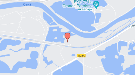
Pincevent on the map, Montereau, France
Photo
Where is located Pincevent
Pincevent — local attraction, which is located at 77130 La Grande-Paroisse, France and belongs to the category — archaeological site. Average visitor rating for this place — 4.3 (according to 3 ratings, information from open sources and relevant for 2022).
Exact location — Pincevent, marked on the map with a red marker.
You can get directions to Pincevent on the map from your location.
What else is interesting in Montereau? You can see all the sights if you go to the city page.
Coordinates
Pincevent, France coordinates in decimal format: latitude — 48.36808624113969, longitude — 2.8930759251119613. When converted to degrees, minutes, seconds Pincevent has the following coordinates: 48°22′5.11 north latitude and 2°53′35.07 east longitude.
Nearby cities
The largest cities that are located nearby:
- Boulogne-Billancourt — 72 km
- Orléans — 94 km
- Reims — 124 km
- Amiens — 173 km
- Rouen — 177 km
- Dijon — 196 km
- Tours — 202 km
- Le Mans — 208 km
- Nancy — 238 km
- Le Havre — 239 km
- Metz — 247 km
- Charleroi
 (Belgium) — 247 km
 - Lille — 248 km
- Caen — 256 km
- Besançon — 263 km
- Namur (Belgium) — 267 km
- Angers — 281 km
- Clermont-Ferrand — 288 km
- Brussels (Belgium) — 289 km
Distance to the capital
Distance to the capital (Paris) is about — 67 km.