
 Puerto de la Duquesa
La Serna de Iguña
Pumalverde
Puentenansa
La Iglesia
Casar de Periedo
Fuengirola
Renedo de Piélagos
Villabanez
Puerto de la Duquesa
La Serna de Iguña
Pumalverde
Puentenansa
La Iglesia
Casar de Periedo
Fuengirola
Renedo de Piélagos
Villabanez
Monte de Valdelatas on the map, Tres Cantos, Spain
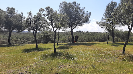
Photo
Where is located Monte de Valdelatas
Monte de Valdelatas — local attraction, which is located at Ctra. Vía de Servicio, 28049 Madrid, Spain and belongs to the category — park. Average visitor rating for this place — 4.5 (according to 336 ratings, information from open sources and relevant for 2022).
Exact location — Monte de Valdelatas, marked on the map with a red marker.
You can get directions to Monte de Valdelatas on the map from your location.
What else is interesting in Tres Cantos? You can see all the sights if you go to the city page.
Coordinates
Monte de Valdelatas, Spain coordinates in decimal format: latitude — 40.536806210398595, longitude — -3.682547575145575. When converted to degrees, minutes, seconds Monte de Valdelatas has the following coordinates: 40°32′12.5 north latitude and -3°40′57.17 east longitude.
Nearby cities
The largest cities that are located nearby:
- Alcobendas — 9 km
- Torrejón de Ardoz — 25 km
- Alcorcón — 30 km
- Leganés — 30 km
- Alcala de Henares — 32 km
- Getafe — 32 km
- Móstoles — 34 km
- Fuenlabrada — 35 km
- Valladolid — 143 km
- Salamanca — 168 km
- Burgos — 193 km
- Logroño — 230 km
- Albacete — 238 km
- Zaragoza — 260 km
- Vitoria-Gasteiz — 263 km
- León — 268 km
- Pamplona — 296 km
- Bilbao — 301 km
- Valencia — 311 km
Distance to the capital
Distance to the capital (Madrid) is about — 13 km.