
 Maureville
Samoëns
Gréning
Toulouse
Volx
Goudet
Méhoncourt
Saint-Hymer
Pontcarré
Maureville
Samoëns
Gréning
Toulouse
Volx
Goudet
Méhoncourt
Saint-Hymer
Pontcarré
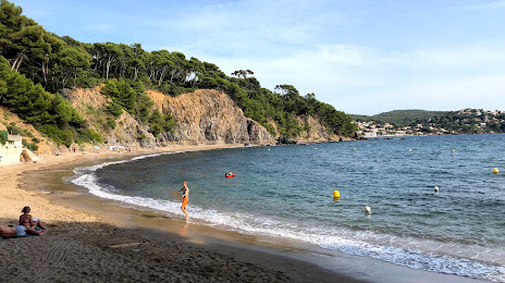
Plage des Bonnettes on the map, La Crau, France
Photo
Where is located Plage des Bonnettes
Plage des Bonnettes — local attraction, which is located at no data and belongs to the category — -. Average visitor rating for this place — 4.2 (according to 93 ratings, information from open sources and relevant for 2022).
Exact location — Plage des Bonnettes, marked on the map with a red marker.
You can get directions to Plage des Bonnettes on the map from your location.
What else is interesting in La Crau? You can see all the sights if you go to the city page.
Coordinates
Plage des Bonnettes, France coordinates in decimal format: latitude — 43.16936111605748, longitude — 6.090263108713844. When converted to degrees, minutes, seconds Plage des Bonnettes has the following coordinates: 43°10′9.7 north latitude and 6°5′24.95 east longitude.
Nearby cities
The largest cities that are located nearby:
- Toulon — 12 km
- Marseille — 59 km
- Aix-en-Provence — 66 km
- Nice — 114 km
- Nimes — 156 km
- Montpellier — 183 km
- Grenoble — 227 km
- Turin
 (Italy) — 247 km
 - Perpignan — 263 km
- Genoa (Italy) — 266 km
- Saint-Étienne — 285 km
- Villeurbanne — 304 km
- Lyon — 305 km
- Novara (Italy) — 322 km
- Geneva
 (Switzerland) — 337 km
 - Sassari (Italy) — 339 km
- Livorno (Italy) — 342 km
- Mataró
 (Spain) — 349 km
 - Milan (Italy) — 352 km
Distance to the capital
Distance to the capital (Paris) is about — 695 km.