
 Bokamoso
Buysdorp
Xihosana
Ga-Sekororo
Ga-Rankuwa
Three Sisters
George
Haenertsburg
Polokwane
Bokamoso
Buysdorp
Xihosana
Ga-Sekororo
Ga-Rankuwa
Three Sisters
George
Haenertsburg
Polokwane
Kambaku Golf Club on the map, Komatipoort, South Africa
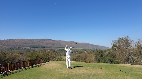
Photo
Where is located Kambaku Golf Club
Kambaku Golf Club — local attraction, which is located at 1 Crocodile street, Komatipoort, 1340, South Africa and belongs to the category — golf club. Average visitor rating for this place — 4.3 (according to 407 ratings, information from open sources and relevant for 2022).
Exact location — Kambaku Golf Club, marked on the map with a red marker.
You can get directions to Kambaku Golf Club on the map from your location.
What else is interesting in Komatipoort? You can see all the sights if you go to the city page.
Coordinates
Kambaku Golf Club, South Africa coordinates in decimal format: latitude — -25.43683592767209, longitude — 31.969694824469155. When converted to degrees, minutes, seconds Kambaku Golf Club has the following coordinates: -25°26′12.61 north latitude and 31°58′10.9 east longitude.
Nearby cities
The largest cities that are located nearby:
- Matola
 (Mozambique) — 73 km
 - Maputo (Mozambique) — 84 km
- Nelspruit — 99 km
- Manzini
 (Swaziland) — 131 km
 - Phalaborwa — 186 km
- Middelburg — 251 km
- Bethal — 271 km
- Vryheid — 280 km
- Polokwane — 306 km
- Embalenhle — 310 km
- Newcastle — 322 km
- Mokopane — 329 km
- Springs — 360 km
- Nigel — 361 km
- Richards Bay — 368 km
- Benoni — 370 km
- Tembisa — 377 km
- Boksburg — 379 km
- Maxixe (Mozambique) — 385 km
Distance to the capital
Distance to the capital (Pretoria) is about — 381 km.